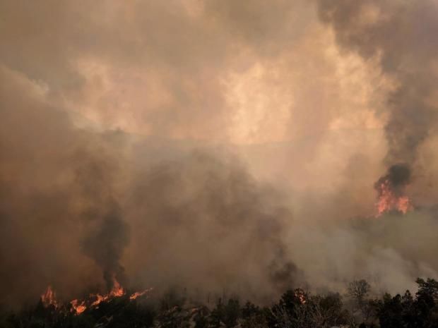
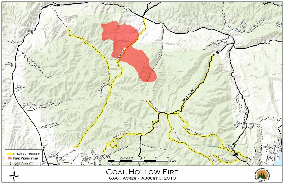
The Coal Hollow Fire in Utah doubled in size in one day. And as it continued to grow on Wednesday, the Utah and Carbon County Sheriff's Offices ordered evacuations, citing "extreme fire behavior."
A lightning strike sparked the fire in Manti-Lasal National Forest, which has grown to over 17,000 feet, created fire whirls with flames extending up to 500 feet into the air, and crossed the Skyline Ridge, a trail in the forest.
On Wednesday evening, the Carbon County Sheriff's Office announced on Facebook that both local and state officials are conducting evacuations of areas, including:
- Fish Creek
- Bear Ridge
- Soldier Summit
- Portions of Aspen Cove
- Portions of Scofield
- All homes south of State Route 6 to the Carbon County Line
- State Route 96 from the junction with State Route 6 to Scofield
Other areas were placed under a pre-evacuation notice and include areas north of State Route 6 from mile marker 195 to mile marker 210.
"Residents and visitors in these areas should be prepared to evacuate by making a plan," the Facebook post said. "Please remember the importance of leaving as soon as requested by authorities for your safety as well as that of emergency responders."
Although State Route 6 is open to cars, the Carbon County Sheriff's Office told drivers that stopping along the route is not allowed. To ensure that traffic continues through the canyon without stopping, the Utah High Patrol and firefighters were patrolling the route.
The Utah County Sheriff's Office implored anyone who lives near evacuation areas or knows anyone who's near the area to "pay close attention to the news and be ready to move out of the way of the fire."
Also burning in the area is the Hill Top fire, which burned almost 2,000 acres, and the Crooked Creek Fire burning about 137 acres.
"It's been a little scary to sit right here and watch where your property is and see the smoke and the fire coming at it," resident Keith Warenski, who evacuated his home, told KUTV.
The crews fighting the two fires, which are close to each other, are sharing resources. Leann Fox, a public information officer for the Utah Division of Forestry, Fire and State Lands, told KUTV that a plane is dropping fire retardant and two black hawk helicopters are being shared to fight the Hill Top fire and the Coal Hollow fire. Despite being close enough to see the smoke burning from both of the fires, officials aren't concerned at this time about the two blazes combining.
The Coal Hollow Fire is at zero percent contained and has 143 people assigned to fight it as the weather remains dry and unstable. Containment is estimated for September 1.
Uncommon Knowledge
Newsweek is committed to challenging conventional wisdom and finding connections in the search for common ground.
Newsweek is committed to challenging conventional wisdom and finding connections in the search for common ground.
About the writer
Jenni Fink is a senior editor at Newsweek, based in New York. She leads the National News team, reporting on ... Read more
To read how Newsweek uses AI as a newsroom tool, Click here.