This article originally appeared in Medium. Read the original article.
In the Israeli-Palestinian conflict, names and maps matter — a lot.
Is the structure between the Israeli and Palestinian territories a separation barrier? A security fence? An apartheid wall? A border? No matter how you name this divider, or other geopolitical lines of demarcation in the region, you risk someone accusing you of harboring inherent bias. On a global scale, peace negotiations have stalled for months and years over how dividing lines — and the areas they divide — are named and detailed on maps.
Even career diplomatic negotiators haven't figured out how to navigate many of these cartographic minefields, so it's not overly surprising that a commercial technology company like Google hasn't gotten this quite right either.
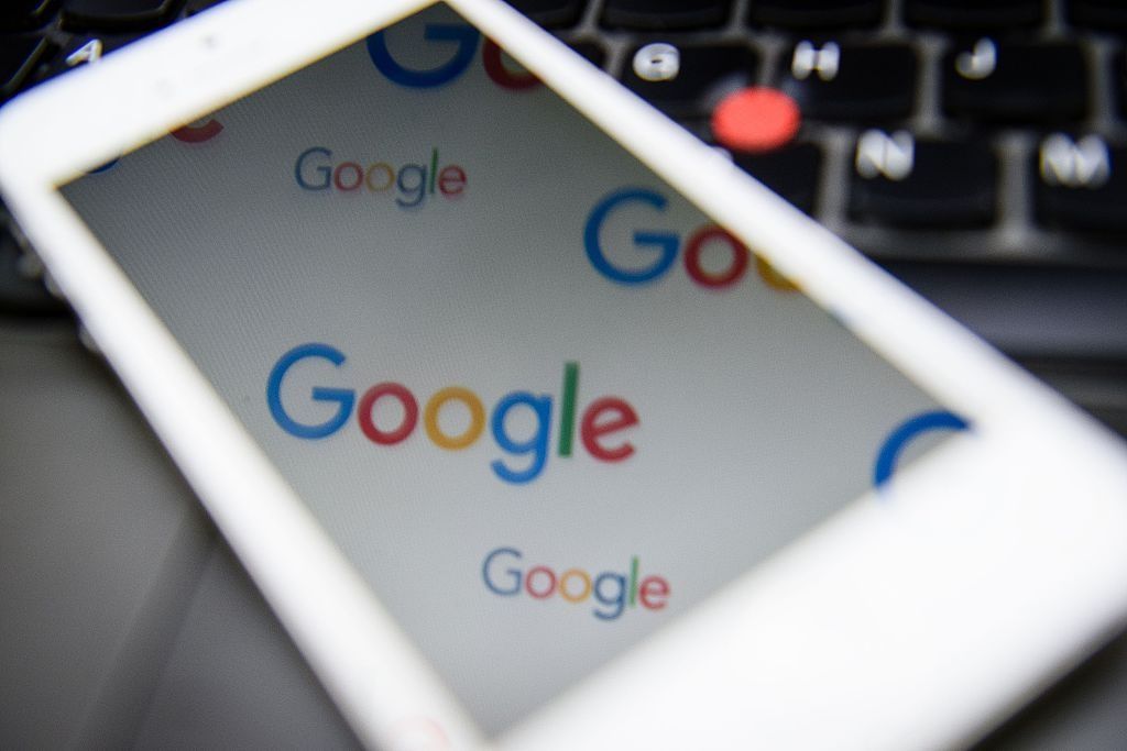
Google's most recent offense? Failing to label "Palestine" on Google Maps, according to more than 300,000 people who signed a petition demanding Google put Palestine back on the map and arguing that the company had no grounds for leaving the territory off. The petition was launched in March, but grabbed renewed attention over the last week.
A screenshot shared by the petitioners shows "Israel" but no label for the area of the West Bank.
Google explained that it never actually labeled the country in the first place:
There has never been a 'Palestine' label on Google Maps, however we discovered a bug that removed the labels for 'West Bank' and 'Gaza Strip,'" the company said in a statement. "We're working quickly to bring these labels back to the area."
This is not the first time the company has come under fire for its labeling decisions regarding the contested sliver of land on the eastern shore of the Mediterranean. In fact, Google is no stranger to geopolitical controversies, and placing last week's news in the context of the company's evolving geopolitical behavior points to the need for a far more thoughtful look at how technology companies are navigating the very analog world of international relations.
Cartography, toponymy (how places are named) and the authority to recognize the sovereignty of other political entities has traditionally fallen to those people and groups holding political power. Since the late Middle Ages, maps have been used by leaders to cement their influence and define political boundaries. As the technology to create and digitally share maps has advanced over the last decade, states' failure to keep official maps up to date and easy to use created a vacuum that technology companies jumped on.
But just because maps are now online doesn't mean they are any more impartial than the paper versions that came before.
When Google set out to launch its Maps and Earth products around 2005, the company probably didn't foresee the extent of challenges it would face once it waded into the politically contentious conversations about borders and geographic labeling.
The company was criticized early on for the potential for its maps to be used by terrorists, while technical bugs and incomplete data (understandable in the early stages of a product) caused some cringe-worthy but minor glitches like the temporary deletion of Malta. Yet until about 2007, Google somehow managed to avoid significant criticism about how it labeled international territories.
One of the early instances of Google Maps' political immaturity flared up when people noticed that Google had marked the Temple Mount (referred to as the Haram al-Sharif by Muslims, and holy to Jews, Muslims, and Christians) in the Old City of Jerusalem as "occupied territory" — terminology that, in the context of Israeli-Palestinian negotiations, suggested the site would ultimately belong to the Palestinians. (The area was annexed by Israel in 1967, but the United Nations considers that section of the city to be "disputed.")
A leader of the Palestinian Al Aqsa Martyrs Brigades praised Google's labeling, saying:
We congratulate Google and the American people in making this very important change in the Middle East. The Al Aqsa Mosque (located on the Temple Mount) is part of Jerusalem, and Jerusalem is part of Palestine. If such a big institution like Google corrected these historical mistakes on maps, maybe we can bring about a change in the depictions of Palestine by the American media, which is controlled by the Zionists.
One geography blogger looked more closely at the border data and explained that Google's Jerusalem error probably stemmed from low resolution data rather than any political intentional choice.
Google didn't immediately comment, but had attributed a related labeling snafu, in which maps showed the Gaza Strip as occupied by Israel even following Israel's 2006 unilateral withdrawal from that territory, to the company's policy of basing its maps on international standards. The company had explained that "borders and place names are not always updated straightaway. Occasionally there are discrepancies. We are happy to receive feedback and will pass it on to the Google Earth team and take the necessary steps."
In 2007 Google stumbled into another territorial dispute, this time in the Arunachal Pradesh territory claimed by both China and India. The Indian publication The Telegraph noticed that Google Earth had changed the color of the Chinese side of the border in a way that implied the territory was administered by China but claimed by India; India argued that the opposite was the case.
The red coloring indicates that the line is not an international border. (Source)
Google Maps showed dotted lines on both sides of the territory, indicating a disputed area. (Source)
In what appears to have been Google's first detailed statement about how it specifically treats disputed borders, the company told The Telegraph:
As a global internet service accessible to users in every country, Google's objective is to provide full information and show and explain all countries' official and authoritatively recognized border claims. Google Earth demarcates its maps according to international standards, following the guidance of the U.S. Federal Information Processing Standards Publication and the International Organisation for Standardisation (ISO) 3166 standards.
By the following week the map had returned to its original labels, with no more comments from the company. That was not the end of the story, however. In August 2009 following a software update, Google suffered a bug that caused city names on its maps of Arunachal Pradesh to be displayed in Chinese characters. This infuriated the Indian government, just as India was preparing for a bilateral meeting with China to discuss border issues.
The next day the company admitted the error and announced, "we are in the process of reverting the data to its previous state and expect the change to be visible in the product shortly… We would like to clarify that this issue did not impact our depiction of international borders." The following month, the labels were corrected.
It's worth noting that India's Criminal Law Amendment Act of 1961 forbids maps that "question the territorial integrity of frontiers of India in a manner prejudicial to the interests of safety and security of India." India also already represented a significant user base for the company, and Google's response could have been aimed at gaining legitimacy in the sizable Indian market and with the Indian government (which the company happened to be lobbying at the time).
In February of 2008, Google stumbled on another flash point when it opted to display the names "Persian Gulf" and "Arabian Gulf" side by side to label the body of water between Iran and Saudi Arabia.
The National Iranian American Council sent a letter to Google CEO Eric Schmidt protesting the dual labels (deeming any label other than "Persian Gulf" offensive). Soon after, a petition was launched calling for the company to delete "Arabian Gulf" from the map entirely. By February 24th the petition had received over 12,000 signatures.
This time, Google responded in more detail than it did after the Arunachal Pradesh incident. Google's Global Director of Public Policy Andrew McLaughlin published a post on the company's Public Policy blog in April, titled "How Google determines the names for bodies of water in Google Earth," in which he announced the introduction of a new policy called "Primary Local Usage."
Under this policy, the English Google Earth client displays the primary, common, local name(s) given to a body of water by the sovereign nations that border it. If all bordering countries agree on the name, then the common single name is displayed...But if different countries dispute the proper name for a body of water, our policy is to display both names, with each label placed closer to the country or countries that use it...By saying "primary", we aim to include names of dominant use, rather than having to add every conceivable local nickname or variation. By saying "common", we mean to include names that are in widespread daily use, rather than giving immediate recognition to any arbitrary governmental re-naming…Finally, by saying "local", we aim to reflect the primary and common names used by countries that actually border the body of water, as they are the countries recognized under international law as having a special sovereign stake in it. In our view, the Primary Local Usage rule generates the optimal combination of neutrality, objectivity, and legitimacy.
McLaughlin explained that the policy was structured to demonstrate neutrality, transparency, and authority in a way that would appeal to the majority of users. He added that the company had considered and rejected other policies such as relying solely on other sources of authority like the U.N. or the International Hydrographic Organization, since these organizations' guidance was not exhaustive and choosing any single organization to follow could inadvertently be seen as political.
Nevertheless, the next week Iran's foreign ministry censured the company, calling Google's dual labeling illegal.
The period of 2007–2008 was important in Google's international expansion ambitions — the company was starting an initiative to make its products available in the 40 most popular languages on the Internet. It wouldn't be unreasonable to assume that the Primary Local Usage policy was meant partly to help Google establish and retain legitimacy in new markets that might disagree about borders or sovereignty.
At the same time, Google had been experimenting with a new strategy to deal with disputed territories. Instead of choosing a single, "neutral" name for a region or landmark, the company would show one version to users from one country, and a different version to another. For the Arunachel Pradesh area, Google Maps began showing users in China a map with the territory marked as part of China, while India saw the territory marked as part of India and the rest of the world saw the area marked as "disputed."
Google accomplished this feat of parallel realities by changing the version of the map that was shown based on which country-level domain was being used (like google.cn in China). The map on the country-level domain represented the official position of that country's government. The same method was reported to have been used for the contentious Kashmir region on the India/Pakistan border — but the company had yet to announce any formal shift in policy.
A more concrete indication that a new policy was in place finally appeared in an official Google Maps and Earth help forum in November of 2009. An unnamed Google employee commented on a question about the Arunachal Pradesh province, saying:
It is Google's standard practice to show all disputed regions around the world on its global properties, such as on maps.google.com. It has been Google's consistent and global policy to depict disputed regions as per the claims made by the disputing/claiming nations on its global properties. This does not in any way endorse or affirm the position taken by any side but merely provides complete information on the prevailing geo-political situation to our users of global properties in a dispassionate and accurate manner.
The post also clarified that maps on local country-level domains would still depict that country's position as required by local laws.
That December, Google policy director Bob Boorstin published an official blog post titled "When sources disagree: borders and place names in Google Earth and Maps," where he laid out the company's new(ish) approach. For the difficult cases, he explained, the company would gather a cross-functional team to review the situation in question based on a hierarchy of values: (1) Google's mission to organize the world's information and provide "ground truth"; (2) authoritative references; and (3) local expectations. (The company has since used the tactic in a number of disputed territories, many of which are documented here).
But the new approach didn't solve all the company's cartographic issues.
On February 5, 2010 the Cambodian government sent an official complaint to Google, calling the company's depiction of an 11th century Khmer temple on the Thai/Cambodia border "radically misleading" and "devoid of truth and reality, and professionally irresponsible, if not pretentious." The map placed territory awarded to Cambodia by the International Court of Justice in 1962 (but still contested by Thailand) on the Thai side of the border. Cambodian and Thai troops had clashed at the border on multiple occasions the prior year.
A Cambodian blog pointed out the discrepancy (source).
A few days later Ross LaJeune, head of government affairs for Google's Asia Pacific office, responded to the Cambodian government in a letter saying that the company recognized the sensitivity of the situation.
We are carefully reviewing the Government of Cambodia's objection regarding the depiction of Cambodian borders in Google Earth, and we plan to respond to your letter more fully in the very near future.
LaJeune noted that the combination of multiple external data sources and the company's reliance on third-party geographic data providers for border information could lead to inaccuracies that might prove difficult to fix on a case-by-case basis. A Cambodian government spokesperson commented that he welcomed the response as a sign of Google's willingness to cooperate.
Possibly prompted in part by this and a similar incident with Vietnam, together with an assumed strategic desire to continue improving its map products in general, Google hired 300 temporary workers for a yearlong effort to improve accuracy of its maps. That July, the company announced it would be releasing improved borders for over 60 countries and regions, and more precise notation to mark international and disputed borders.
The company also (essentially) told people to calm down, because geopolitics is complicated:
In the case of geopolitical features on our maps, the depiction of borders is something upon which local authorities, governments and internationally recognized bodies often disagree. Our goal is to provide the most legible and accurate maps we can given the information available in these oft-changing areas of geopolitical disagreement.
Unfortunately for Google, its border improvements again did not fully succeed in preventing future problems.
The company landed back in the spotlight on November 2, 2010 as former Sandinista and then Nicaraguan military commander Edén Pastora blamed a Google Maps border error for his troops' incursion into Costa Rican territory. Media around the world jumped on the story, referring to the incident as the "Google Maps War."
It soon became apparent that Nicaraguan troops had actually entered the area before consulting Google Maps and that Pastora had in fact justified the incursion based on 19th century treaties and arbitrations.
Nevertheless, Pastora's mention of Google's role prompted the Costa Rican foreign ministry to reach out to the company, which quickly conferred with the U.S. State Department (the source of the company's border data in that area). Although the Nicaraguan Embassy in London announced that the Nicaraguan government was formally requesting Google keep the map as-is, the next day the company posted a statement admitting that the border was wrong and explaining that the maps were in the process of being updated with corrected information.
(It is interesting to note that the outcome of this case is strikingly different than the company's response a few months later, when a border issue in Europe got only minor press coverage and the dispute took place between relatively peaceful neighbors Germany and the Netherlands. The European case, a local German official noted, got no response from the company.)
On July 9, 2011 the country of South Sudan gained independence and two days later was admitted as a U.N. member state, leaving some to wonder how Google — by then a mapping authority — would reflect the changed geopolitical reality in Google products. The company told the editor of the publication UN Dispatch that Google works hard to make maps as accurate as possible and that the company was in the process of updating maps and borders in the region, which would be published the "near future."
Yet Google did not announce completion of the change until two months later, explaining that since the U.N. vote did not include specific demarcation of borders for the new state, the Maps team had to rely on a series of crowd-sourced mapping events to develop the data from scratch.
Since no other authority had updated maps reflecting the new borders, Google—rather than any official body—turned out to be an authoritative player in figuring out the new borders. The company's collaboration with South Sudanese citizens, the World Bank, and the U.N. Institute for Training and Research and Regional Centre for Mapping of Resources for Development (established by the U.N. Economic Commission for Africa) to update the border data suggests the company was hoping to maintain and build its mapping legitimacy in portraying an evolving geopolitical situation.
In early 2012, tensions were rising again off the Arabian/Persian peninsula. That January, Iran threatened to close the Strait of Hormuz in response to potential sanctions by the West over the country's nuclear program. That April the U.S. Navy (which has officially referred to the body of water in question as the Arabian, rather than Persian, Gulf, ever since the 1991 Gulf War ) sent a second aircraft carrier to the area and major publications began speculating about what a potential military clash would look like if negotiations over Iran's nuclear program derailed.
By May 2012, for reasons unannounced, Google removed name labels from the gulf altogether on Google Maps (though both names remained on Google Earth).
The move seemed to come only a few days after Iran celebrated "National Day of the Persian Gulf," commemorating the Persian victory over the Portuguese, and the Iranian government warned Google that it was considering suing the company for its failure to refer to the gulf using the appropriate name. Iran publicly declared that "toying with modern technologies in political issues is among the new measures by the enemies against Iran, (and) in this regard, Google has been treated as a plaything," and threatened "serious damages" if the "Persian Gulf" label were not restored.
A Google spokesperson tried to explain that the company did not label all bodies of water, but also that it did not want to take any political stance. Some media outlets reported that Google's spokesperson could not name any similar examples of bodies of water without labels on Google's maps.
The company appeared to stay quiet on the issue after that, even when several of the company's services were banned in Iran that September (over what was reported to be general mistrust of foreign Internet products). This was not the first time Iran had blocked Google products — YouTube has been unavailable there since 2009. Google would have also been restricted from actively doing business in Iran under U.S. economic sanctions, which covered consumer communications technology devices and software and were not eased until 2013. (Google has reported consistent disruptions to its non-YouTube services in Iran since April 7, 2014.)
It's not clear exactly when Google restored map names to the gulf following the period of military tension, but a search for the body of water on Google Maps from a U.S.-based computer today shows a primary label of "Persian Gulf," with "Arabian Gulf" appearing in parentheses beneath it only after zooming in. (The same results appear no matter which term is used in the search.)
Google launched a localized domain for the Palestinian Territories (google.ps) in August 2009. For the next few years, that domain would take users of Palestinian Internet service providers to a search page with the label "Google Palestinian Territories."
In November 2012 the U.N. General Assembly voted overwhelmingly in favor of making Palestine a "non-member observer state"— an upgrade from its prior designation as an "observer entity." The U.S. voted against the U.N. resolution and criticized any moves to preemptively change the Palestinian entity's political status outside of agreements negotiated directly between Israelis and Palestinians.
Following the vote, the U.N. Statistics Division, which manages the Standard Country and Area Codes for Statistical Use list, reported a change in designation from "Occupied Palestinian Territory" to "State of Palestine" in December. This triggered a corresponding change on the International Standardization Organization's (ISO) 3166–1 list, a widely used source for country codes, including by tech companies.
So, despite the fact that there was no bilateral resolution of the long-running Israeli-Palestinian conflict, the .ps country code was nevertheless now associated with the name "State of Palestine."
Palestinian users immediately called attention to the change, and a cascade of media stories followed the controversial move. With headlines like "Statehood via Google" and "Google nod to Palestine as a nation," many claimed the move meant that Google had effectively recognized Palestine as a state.
Within days of the change, Israel — whose position is to not recognize the existence of a Palestinian state outside the context of a political agreement — publicly requested that Google reconsider, and continued lobbying the company over the following months. The company declined to revert back to the earlier label, insisting that it had followed its internal policy of consulting the U.N., ISO, and the Internet Corporation for Assigned Names and Numbers (ICANN), the organization that manages the assigning of country top-level domains.
While Google entertained meetings with Israeli government representatives at the company's headquarters in Mountain View, California, sent a delegate to Jerusalem to testify at a hearing of the Knesset's Science and Technology Committee, and even promised to update Israel about related changes in the future, the company continued to reiterate its stated policy of following international standard-setting bodies and rejected requests to change the label back.
While Google has updated its policy tactics related to cartography and toponymy over time (due in part to evolving political situations, but also due to the company's technical solutions like showing different maps across local domains), it seems clear that the company has been driven by the desire to be regarded as a legitimate, authoritative source of information. Sometimes local laws require it to change labels, and bad data can also be at fault. The latter seems to have been at fault in the most recent Palestinian labeling issue.
Google executives have recognized that the company is playing a growing role in international affairs. In recent years it has found itself (alongside Facebook, Twitter, and other Silicon Valley giants) dealing with an ever increasing number of decisions that used to concern only countries and political leaders — questions of diplomatic relations, international development, global governance and even appropriate response to terrorism.
With long-documented geopolitical history of countries and nation-states available to study and analyze, by now most people generally understand how national governments will make such decisions. Companies like Google have only become major players on the geopolitical scene in the last decade, and their decisionmaking is still evolving, under-researched, and not similarly predictable.
In light of the growing political impact of decisions by Google and its peers, journalist and Internet freedom advocate Rebecca MacKinnon called, back in 2012, for a systematic look at corporate behavior in the global political system:
More than three hundred years since the Treaty of Westphalia and over two hundred since the world's first democracy was established, we have a reasonable understanding of how nation-states wield power and how state power can be constrained by constitutions, elections, laws, and international treaties. We lack a similar understanding of how various kinds of transnational digital platforms and the organizations that build them derive and wield their power; to whom, if anyone, they are accountable; and how their power can best be constrained in a way that does minimal harm and maximum good.
MacKinnon's Ranking Digital Rights project, through its Corporate Accountability Index, has started pointing out the various ways in which tech companies deal with governments and whether these companies sufficiently protect users' rights like freedom of speech.
But this type of push for corporate accountability is just a start. As consumers continue to trust tech giants with our data, our rights, and now — with the introduction of technology like self-driving cars — our lives, and as these companies continue amassing influence in foreign policy conversations, we should be looking closely at the decisions that the Googles and Facebooks of the world are making in the international political context. Maps, place names and borders are just the tip of the iceberg.
Miranda Bogen is an associate at Upturn, a tech policy firm, has a masters degree from The Fletcher School of Law and Diplomacy at Tufts University with a focus on international technology policy and international business strategy, and is a former Google policy fellow for the Summer of 2015.
Uncommon Knowledge
Newsweek is committed to challenging conventional wisdom and finding connections in the search for common ground.
Newsweek is committed to challenging conventional wisdom and finding connections in the search for common ground.
About the writer
To read how Newsweek uses AI as a newsroom tool, Click here.