A tropical system has high odds of developing into a named storm in the Gulf of Mexico early next week. It could ultimately threaten Louisiana or other Gulf Coast areas with heavy rainfall or worse, as a named tropical cyclone, according to some forecast models. The National Hurricane Center latest forecast now gives the system a 50 percent chance of development within five days.
If it develops into a tropical cyclone, the next name up is Michael.
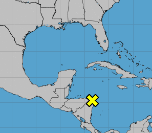
The system is currently located near Cabo Gracias a Dios on the eastern border of Honduras and Nicaragua but it is expected to move slowly north in the next few days into the southern Gulf of Mexico or the northwestern Caribbean Sea where conditions for cyclone development will be more favorable. Currently, the area of low pressure that's accompanied by "extensive disturbed weather," it is encountering upper-level winds inhibiting development.
But as the system moves north in the next few days, conditions for tropical cyclone formation will be more favorable, the National Hurricane Center said, giving the system high odds of becoming a named storm and the next name up is Michael.
Forecaster Dr. Jeff Masters of Weather Underground agrees that diminishing wind shear as the system moves north increases its likelihood of tropical cyclone development.
"The shear over the Western Caribbean will relent this weekend, when the subtropical jet stream is predicted to lift to the north, so that it is positioned over Cuba," Dr. Masters reported on Weather Underground. "This will create a region of lower wind shear over the central and western Caribbean. "The (European model) and (UKMET model) predicted that a tropical depression would form in the southern Gulf of Mexico, just north of the Yucatan Peninsula, by Tuesday."
Dr. Masters said the system may be slow to develop due to conditions, but some models show the storm's path leading to Louisiana, where a heavy rain event could unfold next week at the very least if track models are correct.
"The most likely type of storm that might evolve in the Gulf next week is a large and slow-to-intensify ugly-looking mess of a storm that would primarily be a heavy rain threat," Dr. Masters said. The track such a storm might take would most likely be to the north, towards Louisiana, but we can't rule out a threat to any region of the Gulf Coast at this point. "
In the meantime, the system will likely bring torrential rains primarily to portions of Central America and the Yucatan peninsula during the next few days, the National Hurricane Center said.
Forecasters in the Slidell, Louisiana office of the National Weather Service said today that forecast models expect disturbance to reach the southeastern Gulf early next week. The "main idea for now is there is a potential for a tropical system in the Gulf next week, with low confidence on track and intensity at this time," the Slidell office forecast note said.
Uncommon Knowledge
Newsweek is committed to challenging conventional wisdom and finding connections in the search for common ground.
Newsweek is committed to challenging conventional wisdom and finding connections in the search for common ground.
About the writer
To read how Newsweek uses AI as a newsroom tool, Click here.