In 2015, a new land emerged in the South Pacific. The eruption of an underwater volcano had sent ash and lava spewing into the sea for over a month. As the ash mixed with the warm water, it solidified into a rock and, over the course of a month, this rock built up enough to create a new island.
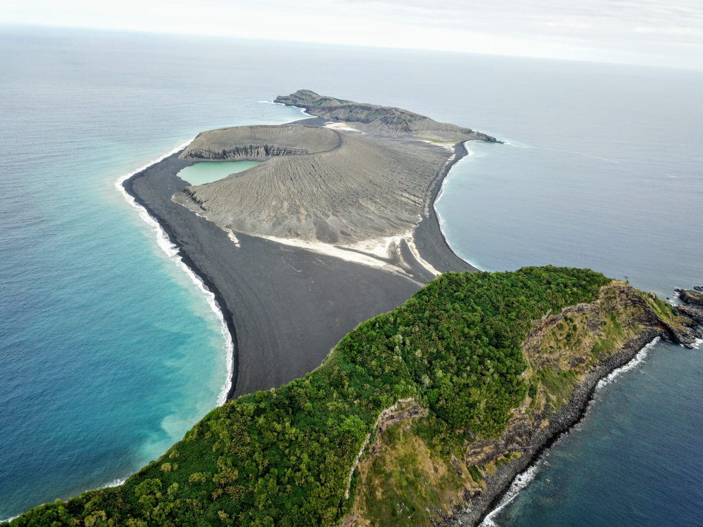
The island was nestled in between two landmasses—Hunga Tonga and Hunga Ha'apai—hence its name, Hunga Tonga-Hunga Ha'apai (HTHH).
Underwater volcanic eruptions often form small new islands but they are normally very short-lived—the ocean waves quickly erode the rock and they disappear back into the sea. HTHH, however, did not vanish. Instead, it grew to be over a mile wide and long, and almost 400 feet in height. In 2017, NASA scientists studying the island estimated it would last for between six and 30 years—providing researchers with an unprecedented insight into the early life and evolution of a new land.
By understanding the processes taking place on HTHH, researchers believe they will be able to get an insight into the otherworldly features on places like Mars. "Everything we learn about what we see on Mars is based on the experience of interpreting Earth phenomena," Jim Garvin, chief scientist of NASA's Goddard Space Flight Center, said in a statement at the time. "We think there were eruptions on Mars at a time when there were areas of persistent surface water. We may be able to use this new Tongan island and its evolution as a way of testing whether any of those represented an oceanic environment or ephemeral lake environment."
NASA scientists have now traveled to the island and explored it for the first time. Before this, their only experience of the landscape was from satellite images—which can be misleading. "There's no map of the new land," said Dan Slayback, also of the Goddard Space Flight Center.
Slayback, Garvin and Vicki Ferrini, from Columbia University, have spent the last three years making a 3D model of HTHH. Working with the Woods Hole's Sea Education Association, they sailed around the northern coast of the island taking GPS measurements, before finally setting foot on HTHH.
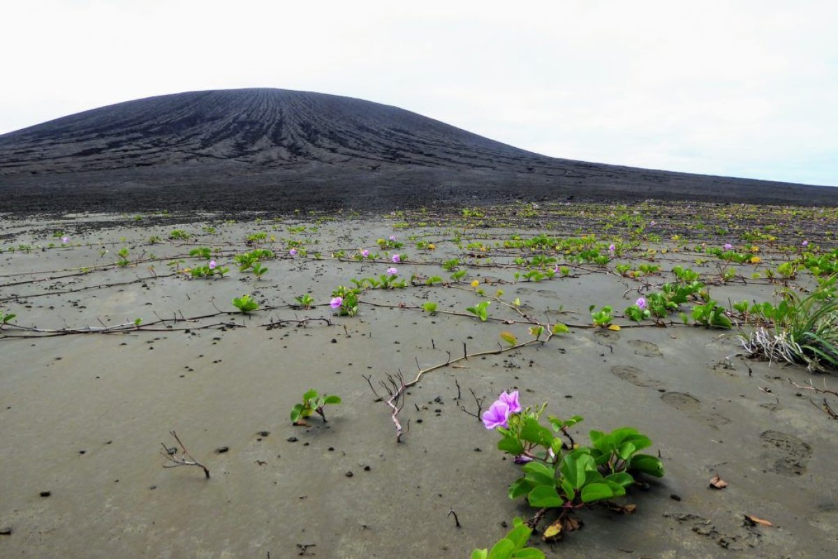
"We were all like giddy school children," Slayback said. "Most of it is this black gravel, I won't call it sand—pea-sized gravel—and we're mostly wearing sandals so it's pretty painful because it gets under your foot. Immediately I kind of noticed it wasn't quite as flat as it seems from satellite. It's pretty flat, but there's still some gradients and the gravels have formed some cool patterns from the wave action.
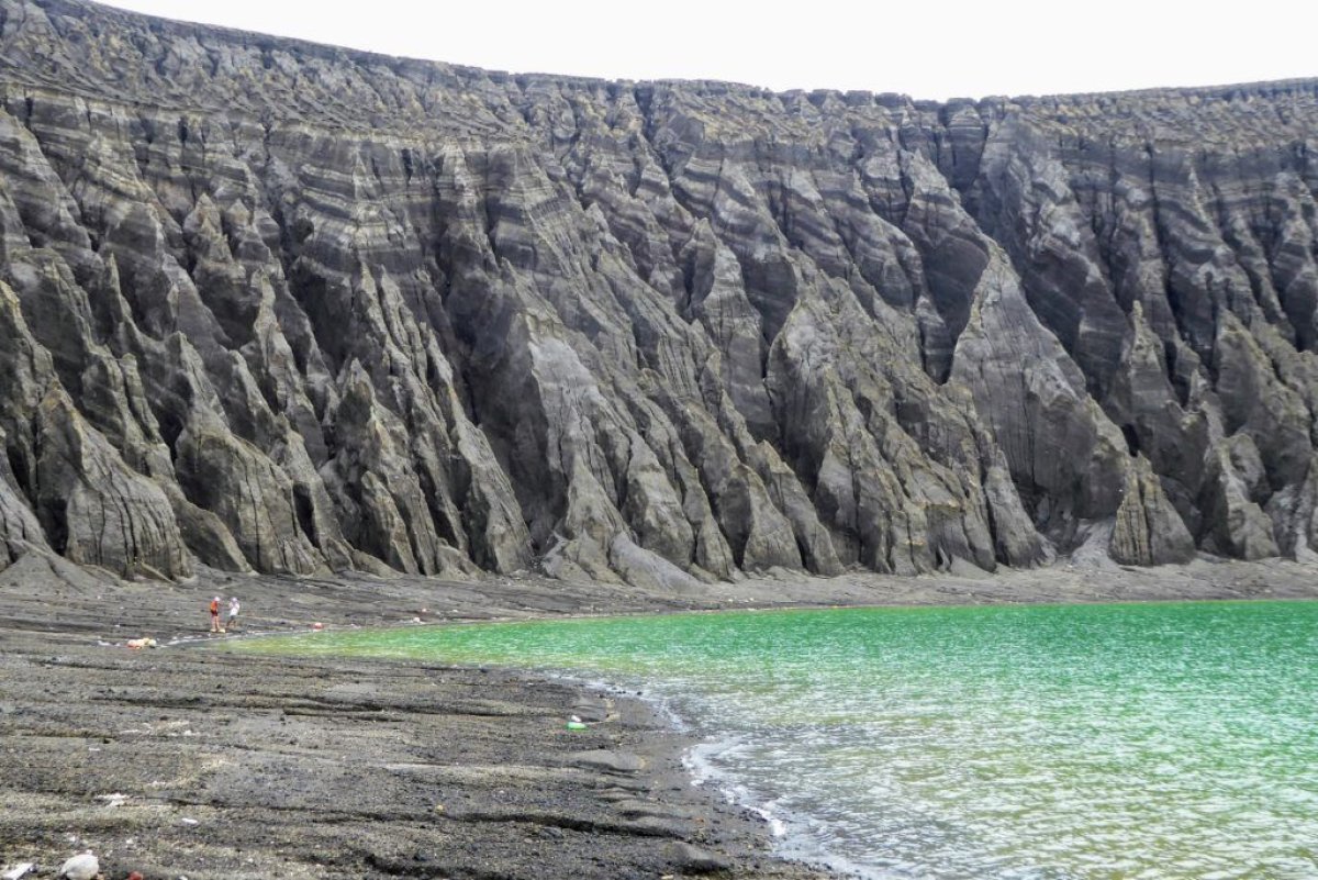
"And then there's clay washing out of the cone. In the satellite images, you see this light-colored material. It's mud, this light-colored clay mud. It's very sticky. So even though we'd seen it we didn't really know what it was, and I'm still a little baffled of where it's coming from. Because it's not ash."
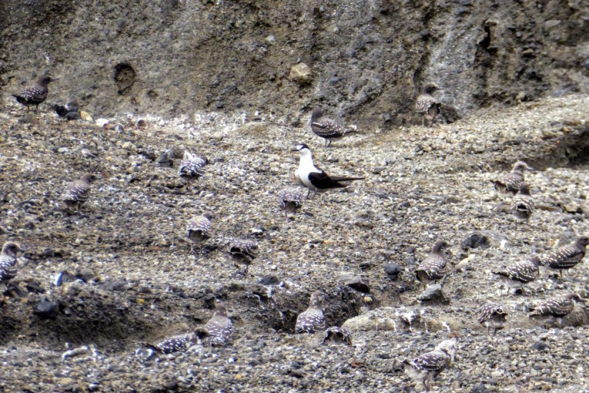
The team discovered vegetation growing on the island, apparently having been seeded by bird droppings. They also saw a barn own and hundreds of nesting sooty terns living on HTHH.
They also took high-precision measurements of the land so they can produce a higher-resolution 3D map. This will allow them to monitor the erosion of the island over the coming years. "The island is eroding by rainfall much more quickly than I'd imagined," Slayback said. "We were focused on the erosion on the south coast where the waves are crashing down, which is going on. It's just that the whole island is going down, too. It's another aspect that's made very clear when you're standing in front of these huge erosion gullies. Okay, this wasn't here three years ago, and now it's two meters deep."
The team now plans to work out the volume of the island and how much ash erupted from the volcano's vent. Garvin said: "Volcanic islands are some of the simplest landforms to make. Our interest is to calculate how much the 3D landscape changes over time, particularly its volume, which has only been measured a few times at other such islands. It's the first step to understand erosion rates and processes and to decipher why it has persisted longer than most people expected."
Uncommon Knowledge
Newsweek is committed to challenging conventional wisdom and finding connections in the search for common ground.
Newsweek is committed to challenging conventional wisdom and finding connections in the search for common ground.
About the writer
Hannah Osborne is Nesweek's Science Editor, based in London, UK. Hannah joined Newsweek in 2017 from IBTimes UK. She is ... Read more
To read how Newsweek uses AI as a newsroom tool, Click here.