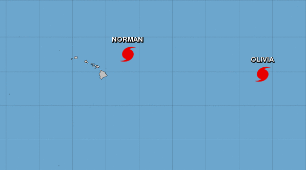
The hurricane that was sitting east of the islands of Hawaii for the past several days will continue its movement north and likely miss the islands entirely.
Hurricane Norman won't cause any problems for those on the islands, other than rough surf in some areas due to its high wind speeds out at sea, according to the National Hurricane Center (NHC). Norman was traveling 8 miles per hour on Thursday night and was a Category One hurricane at that point, with maximum sustained surface winds at 85 mph.
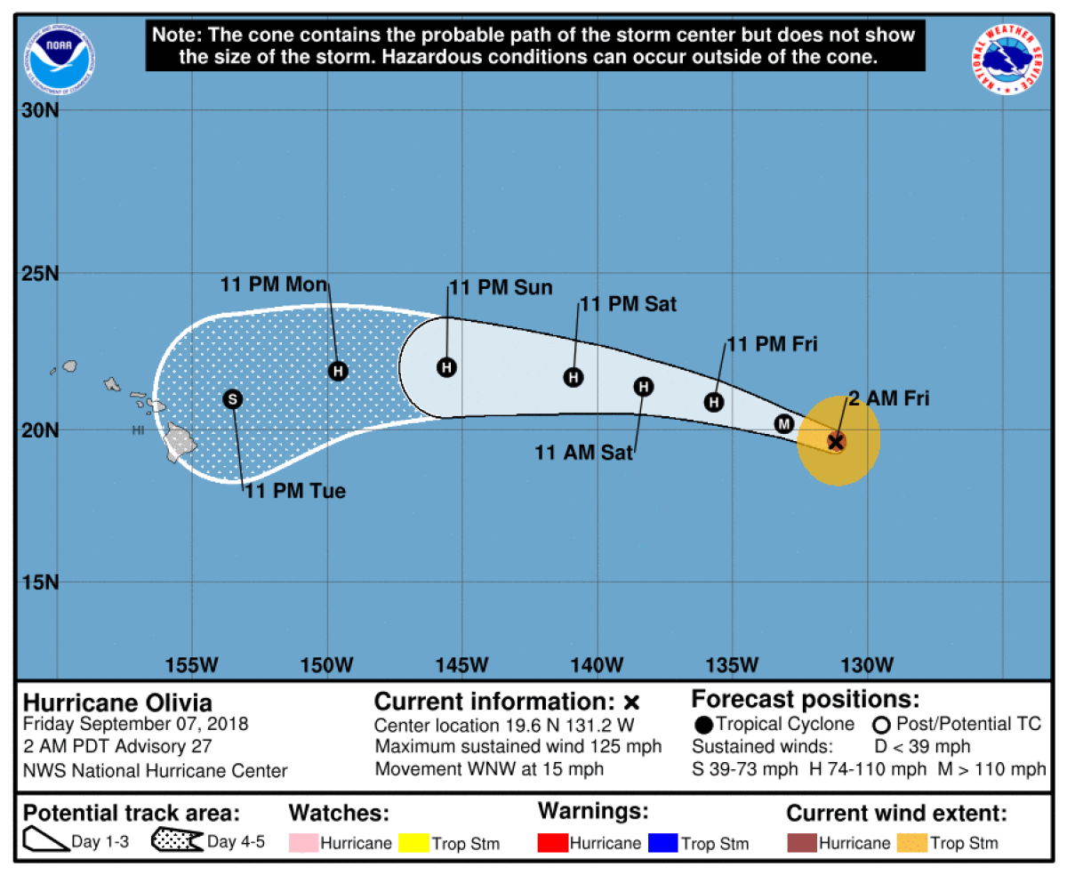
A second hurricane that has formed in the Pacific, Hurricane Olivia, was not taking the same northward path as Norman and was actually expected to head right for the islands by early next week. The latest prediction map from the NHC shows Olivia on track to begin bringing severe weather to the islands as early as Monday or Tuesday.
Olivia was a Category 3 Hurricane with maximum sustained wind speeds of 110 mph and was traveling west-northwest at 15 mph Friday. The National Weather Service (NWS) issued a hurricane warning for the waters around the islands of Hawaii.
For the coming days, the summary from the NWS of the expected weather on the islands mentioned Olivia briefly. "Hurricane Olivia is forecast to approach the islands from the east early next week, then move through the region from east to west Tuesday night through midweek," said the NWS forecast.
Behind Olivia, off the west coast of Mexico, a disturbance was forming in the warm waters of the Pacific. On Friday it was a few hundred miles off the southern coast of Baja, California, but there was a 60 percent chance it would turn into a tropical depression over the weekend. The chance of it forming into a tropical depression over the next five days was even higher, at 90 percent.
As of Friday, that disturbance was an area of low pressure over the water, producing thunderstorms and rain showers. The weather was expected to be conducive to the disturbance turning into a depression.
Those on Hawaii should pay attention to local reports from authorities regarding the storms and any preparation necessary. The NWS and other local media outlets will have information regarding Olivia's development. As of Friday, the biggest concern for those on the islands was the high surf and more dangerous waters caused by the winds of the nearby storms.
Uncommon Knowledge
Newsweek is committed to challenging conventional wisdom and finding connections in the search for common ground.
Newsweek is committed to challenging conventional wisdom and finding connections in the search for common ground.
About the writer
Nina was a breaking news reporter. She previously worked at Business Insider, The Boston Globe, and Boston.com.
To read how Newsweek uses AI as a newsroom tool, Click here.