The Kilauea volcano has been highly active for the past two months, forging a path of destruction and upending the lives of Hawaii's residents. Homes have been decimated by lava flowing across the island, while the summit of the volcano has continued to change.
As the magma flows out of the crater and across the island, the caldera has been dropping. The caldera is the area above the magma pit of the volcano that becomes a depression in the land as the magma flows away. The United States Geological Survey has recorded images of the summit caldera each day for the past month, and the resulting time-lapse shows the great distance the caldera has fallen.
Time-lapse (June 13-July 7) shows changes at Kīlauea Volcano’s summit caldera; floor subsides as magma drains toward the #LERZ. https://t.co/17qXRYrJCe pic.twitter.com/Fd5teUshHc
— USGS Volcanoes🌋 (@USGSVolcanoes) July 11, 2018
While the USGS doesn't have a specific measurement of how far the caldera has dropped, it noted on Twitter that each of the volcano's collapse and explosion events produce 1 to 2 meters (about 3 to 7 feet) of change.
The collapse and explosion events happen almost daily, sometimes occurring multiple times a day. Amid a collapse, the ground shakes as it would in an earthquake, and causes seismic shocks that spread about the island, some of which feel as severe as a magnitude 5 earthquake.
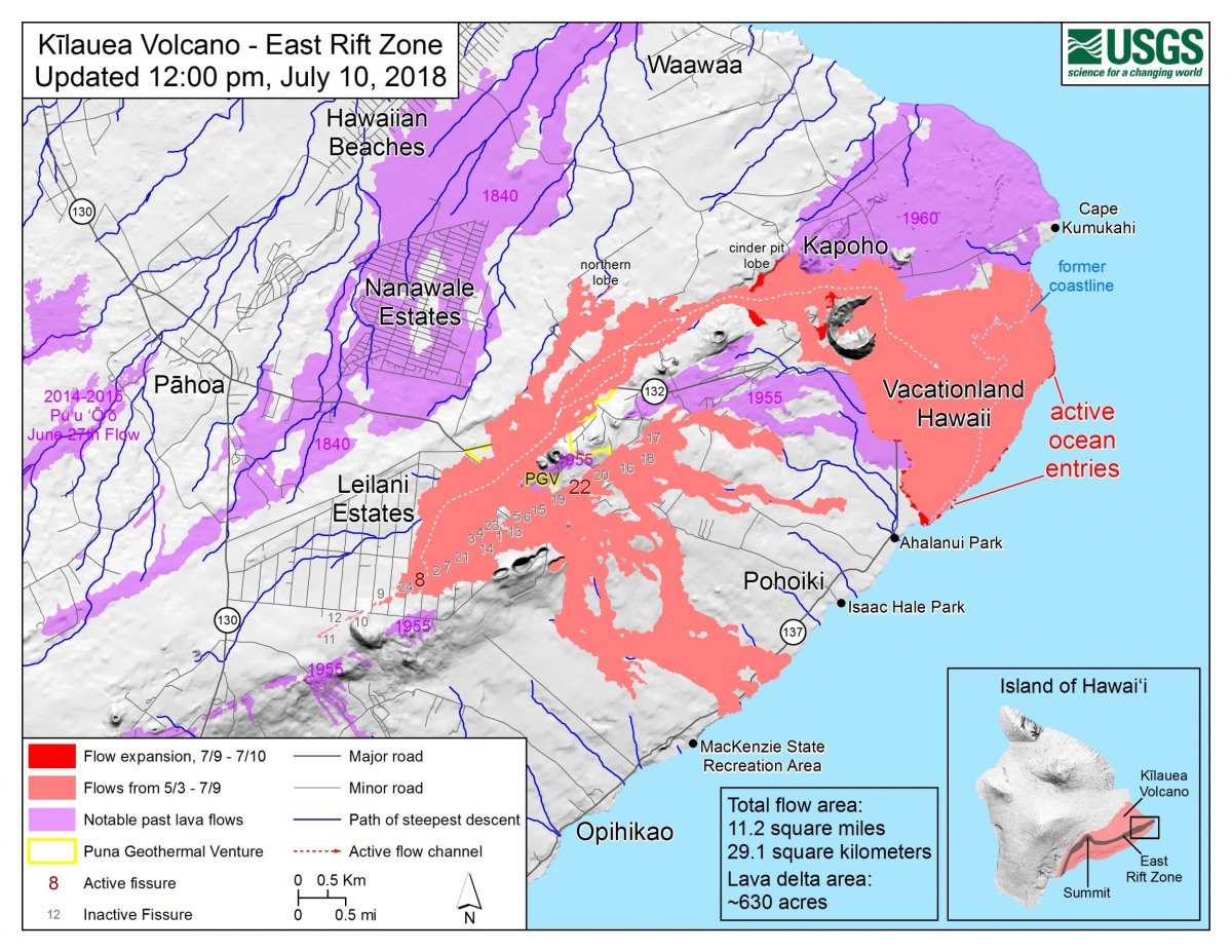
Most of the lava has been flowing from one eruption point, called Fissure 8, in a sort of river or channelized flow. Earlier this week that channel, or river, experienced a block that caused the edges to overflow, according to the USGS.
Those small overflows caused by the block resulted in some brush fires in the area. The USGS expected similar blocks and overflows along the channel edges, or river banks, to continue. "Additional blockages and resulting overflows are likely to occur as long as the activity continues," said an update from the USGS.
Another possible block had formed in the channel as of Tuesday afternoon, according to a Hawaii Civil Defense update on the volcano.
"Do not access the active flow field due to extreme hazard," the agency said.
#KilaueaVolcano #LERZ updatehttps://t.co/7sDZqcOJ5s
— USGS Volcanoes🌋 (@USGSVolcanoes) July 10, 2018
Yesterday #Fissure8 #lava channel blocked and overflowed - mostly atop earlier lavas. Flow towards #CinderRoad stalled. Flow west of #Kapoho Crater active w/ small brush fires.#Oceanentry active, southern margin stalled. pic.twitter.com/GFh0ff62KV
As the lava flows, it releases sulfur dioxide into the air, which could cause acid rain to fall on the island. Additionally, at the ocean's entry points, there was lava haze, or laze, plumes that continued to release hydrochloric acid into the surrounding area. Both of these gases can irritate the skin, eyes and lungs. The laze plume is especially dangerous, and residents were advised to avoid the ocean entry point.
Uncommon Knowledge
Newsweek is committed to challenging conventional wisdom and finding connections in the search for common ground.
Newsweek is committed to challenging conventional wisdom and finding connections in the search for common ground.
About the writer
Nina was a breaking news reporter. She previously worked at Business Insider, The Boston Globe, and Boston.com.
To read how Newsweek uses AI as a newsroom tool, Click here.