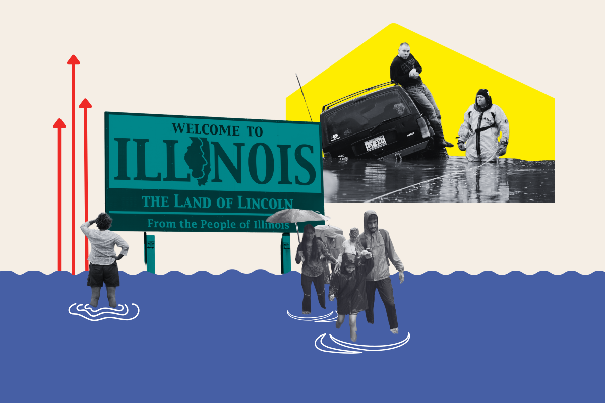
Scientists have created an interactive map that shows how parts of Illinois may be swallowed up by Lake Michigan as climate change bites.
The Great Lakes in the Midwest comprise the largest unfrozen freshwater stores on Earth, but experts have forecast that rising water levels could have serious consequences.
More than 30 million people live along the lakes' roughly 4,500 miles of coastline, which stretches across the U.S. and Canada, and touches upon the cities of Chicago, Detroit and Buffalo, New York. That means millions of families could be hit hard by new, higher water levels, which could potentially wash away homes and jobs in the surrounding areas in the future.

"New research using the most advanced regional climate modeling systems finds that the baseline lake level for Lake Superior, Michigan-Huron and Erie are expected to rise by roughly 20 to 50 centimeters [up to half a meter, or 1.6 feet] by 2050 as a result of climate change," researchers at the American Geophysical Union (AGU) wrote in a report published in June 2022. "Like sea level rise, higher lake levels can increase coastal erosion, change navigation considerations and increase the risk of coastal flooding."
But others believe the rises in lake water levels could potentially be even more "dramatic."
Research by Michigan Technological University in 2022 revealed: "Over the past decades, the water levels of the Great Lakes have undergone dramatic fluctuations, exhibiting a range exceeding 2 meters [over 6 feet]. These changes are due to climate-induced alterations in the three primary components of the lakes' water budget: over-lake precipitation, lake evaporation, and basin runoff."
Now, curious Americans can use a tool created by the National Oceanic and Atmospheric Administration (NOAA) to conduct their own research. The government agency has created an interactive map showing how the lake's shorelines would change under various level rises.
Lake Michigan, which is bordered by Illinois, Wisconsin, Indiana, and Michigan, is shown with a current Low Water Datum (LWD) level of 1.90 feet, with a high LWD of 4.92 feet. But if that level is raised to a LWD level of 10 feet—the worst scenario possible on the interactive map—the effects would be catastrophic.

Much of South Chicago is flooded, along with a huge swathe of the East Side. Whole neighborhoods are submerged underwater, with the newly-flooded areas heading as far inland as Marian R. Byrnes Park and the Chicago Bureau of Sanitation. Lawrence Elementary School would also have been lost to the lake.
It's not just lakes that are forecast to suffering rising water levels; seas will be affected too.
NOAA Oceanographer Billy Sweet told Newsweek in an emailed statement on Friday, April 12, that the agency's interactive tools are "a versatile mapping platform that provides insights on what lies in harm's way." For example, the sea mapping tool shows what would happen as a result of an "on-going sea level rise or flooding from full-moon tides to hurricane storm surges," he said, adding: "Due to decades of sea level rise, high tides are drowning wetlands and routinely flooding U.S. coastal communities, disrupting commutes and commerce and requiring extensive upgrades to public works like storm- and waste-water systems."
The United Nations' Intergovernmental Panel on Climate Change estimates there is likely to be a steep sea level rise by the year 2100 if global greenhouse gas emissions are not mitigated; an increase "of 2 or more meters [almost 6.6 feet] cannot be ruled out," officials said.
A rise of 6ft in sea levels would see the U.S. state of Georgia badly hit, while large portions of Los Angeles and San Diego would also vanish, and parts of New York would end up underwater.
Uncommon Knowledge
Newsweek is committed to challenging conventional wisdom and finding connections in the search for common ground.
Newsweek is committed to challenging conventional wisdom and finding connections in the search for common ground.
About the writer
Get in touch with Chloe Mayer by emailing c.mayer@newsweek.com
To read how Newsweek uses AI as a newsroom tool, Click here.