The enormous Mississippi River, the 13th largest river in the world in terms of flow, occupies a central place in U.S. geography, economy and culture.
The river is a huge part of the country's agriculture system, with 92 percent of the nation's agricultural exports being produced in the Mississippi basin, which equates to 78 percent of the world's soybeans and grain exports.
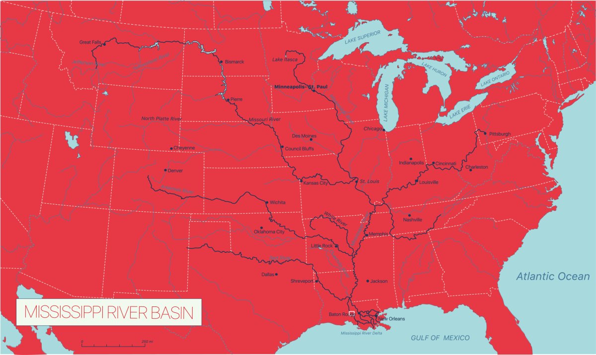
Mississippi River Map
The Mississippi is the second longest river in the U.S., second only to the Missouri River. The river passes through 10 states—Minnesota, Wisconsin, Iowa, Illinois, Missouri, Kentucky, Tennessee, Arkansas, Mississippi, and Louisiana. Its 1.2 million square mile drainage basin includes 32 U.S. states and two Canadian provinces, with its many tributaries draining water into the main river stem. Some 41 percent of the continental U.S. drains into the Mississippi.
Who Discovered the Mississippi River?
Spanish conquistador and explorer Hernando De Soto is often cited as having discovered the Mississippi in 1541.
However, prior to the arrival of Europeans in the U.S., native Americans had lived alongside the river for thousands of years.
"In terms of "discovery", indigenous people have lived along the Mississippi River for over 10,000 years," Samuel E. Muñoz, an assistant professor in the Department of Marine & Environmental Sciences at Northeastern University, told Newsweek.
"But from a European perspective, the Mississippi came to the U.S. as part of the Louisiana purchase (from France, which had a string of forts along the St. Lawrence Seaway, into the Great Lakes, and down the Mississippi)," Jeremy Bricker, an associate professor of civil and environmental engineering at the University of Michigan, told Newsweek.
How Long Is the Mississippi River?
The Mississippi is around 2,350 miles long from source to end. There is some debate about the exact length of the river, depending on the year or measurement method, according to the U.S. National Park Service (NPS). The U.S. Geological Survey states that the river is 2,300 miles long, while the EPA claims that it's 2,320 miles long. The Mississippi National River and Recreation Area suggests 2,350 miles, while Itasca State Park says that the river is 2,552 miles long.
The Mississippi occupies a key place in U.S. culture thanks to it being the setting for Mark Twain's most famous novels, Adventures of Huckleberry Finn and The Adventures of Tom Sawyer.
Where Does the Mississippi River Begin and End?
The Mississippi river starts in Lake Itasca in Minnesota.
"The starting point of a river is a bit fuzzy, because it could either be the first place where substantial surface water gathers or it could be the edge of its drainage basin—the furthermost area of ground where a drop of rain could flow into the river," Mathew Barlow, a professor of climate science at the University of Massachusetts Lowell, told Newsweek.
The river then flows out into the Gulf of Mexico.
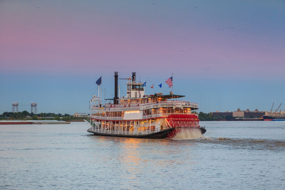
"The Mississippi River ends in the iconic "birds-foot" at the southern tip of Southwest Pass, the main navigation outlet, about 160 river miles downstream of New Orleans in Louisiana, one of the oldest ports in the U.S.," G. Paul Kemp, an adjunct professor and coastal oceanographer and geologist at Louisiana State University, told Newsweek.
🔥 The Mississippi River and its many tributaries 🔥 pic.twitter.com/HmHkl8OLv7
— Nature Is Lit (@NatureIs_Lit) March 1, 2023
How Wide Is It?
The river ranges massively in width, between around 20 to 30 feet at its narrowest near Lake Itasca, to about 11 miles at its widest point at Lake Winnibigoshish near Bena, Minnesota, according to the U.S. NPS.
Which Way Does the Mississippi River Flow?
The Mississippi flows southwards from its source at Lake Itasca in Minnesota to the Gulf of Mexico, at an annual average discharge rate of 593,003 cubic feet of water per second. Pollution from the river, mostly increased nutrients from agricultural and fertilizer runoff, has contributed to the Gulf of Mexico (GOM) "dead zone" over the past few hundred years.
"The GOM "dead zone" is a phenomenon that occurs on part of the Louisiana continental shelf that generally begins west of the outlet of the Atchafalaya River and can expand west into Texas by late summer and early fall," Kemp said. "It is a seasonal condition that is present typically in the bottom one to two meters of the water column when it is stratified (fresh river water on top—colder, saltier GOM water on the bottom."
"It forms when the Mississippi River is at high discharge and is putting a lot of sediment and plant nutrients, mostly from fertilizers applied to farmlands in the mid-west corn belt. The river is turbulent and muddy but the mud drops out when the outflow reaches more quiescent areas of the inner continental shelf," Kemp continued.
As the fresher river water clears, tiny marine algae called phytoplankton are stimulated by the newly available sunlight and the high dissolved nitrogen concentrations, growing rapidly in an algal bloom.
"Vast amounts of buoyant plant biomass is formed by the photosynthesis process that forms the base of the marine ecosystem food web. Because the water on the shelf is stratified, as the tiny plants die, they fall into the more salty water at the bottom and eventually reach the seabed," said Kemp.
There, a whole different ecosystem of bacteria and other decomposers use any oxygen in the bottom water to break down the plant biomass. If no big storms break up the stratified conditions, much of the oxygen in the bottom water closest to the bottom is used up by the decomposers and cannot be replenished by air diffusing into the water at the surface.
"When the phytoplankton die, they sink and decompose, which consumes oxygen. The water becomes hypoxic (low oxygen level) or anoxic (no oxygen), causing fish and other critters to die. Hence a dead zone," Bricker said.
Threats to the Mississippi
"[The Mississippi is] threatened in multiple ways, unfortunately," Barlow said. "Due to both rising temperatures, which make the land and air 'thirstier,' as well as increasing year-to-year fluctuations in rainfall amounts, we expect an increase in both floods and very low flow years going forward. The 2022 flash drought is a recent example of a rapid swing toward low flow conditions, with major disruptions to shipping."
In recent years, the drought that has been plaguing much of the U.S. has caused the Mississippi to fall to its lowest levels for a decade, exposing a number of shipwrecks that had previously been hidden beneath the water.
This is expected to worsen as the effects of climate change continue to worsen the drought and increase temperatures.
"Climate change will certainly change the river's hydrological regime, as it will all rivers For one, much of the river flow is currently supplied by snowpack, but climate change is reducing the snowpack, which will be replaced with more rain," Bricker said.
Snowpack melts gradually in the warmer months, keeping water in the river throughout the summer.
"In a warmer climate, more precipitation falls as rain instead of snow. In the winter this has the result of increasing the potential for flooding, because all that rain enters the river rapidly, instead of being stored as snow and getting gradually released into the river as snowmelt in the spring/summer," Bricker said.
"The lack of snowpack also means that summers are more likely to experience drought and low water levels. This affects irrigation and water supply for most of the Midwest, as the river is a source of irrigation and drinking water. It also affects barge navigation, as the Mississippi is a maritime highway for barges shipping agricultural and other industrial products. During summer droughts, water levels can drop too low to support barge traffic."
Do you have a tip on a science story that Newsweek should be covering? Do you have a question about the Mississippi? Let us know via science@newsweek.com.
Uncommon Knowledge
Newsweek is committed to challenging conventional wisdom and finding connections in the search for common ground.
Newsweek is committed to challenging conventional wisdom and finding connections in the search for common ground.
About the writer
Jess Thomson is a Newsweek Science Reporter based in London UK. Her focus is reporting on science, technology and healthcare. ... Read more