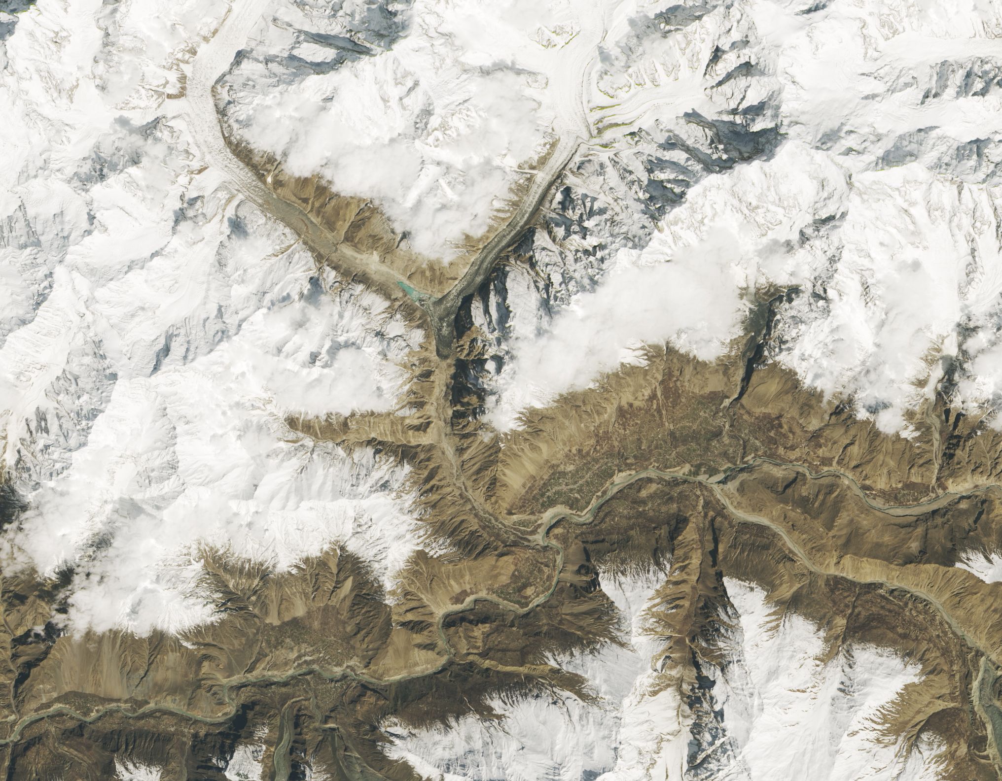
A NASA satellite has captured spectacular images of a fascinating natural process taking place, deep in the Greater Himalayan region.
Most of the glaciers in this area of Asia—which contains many of the world's highest peaks—are retreating and melting. But about 200 in the Karakoram Range, spanning the borders of Pakistan, India and China, are actually doing the opposite due to a process known as "surging."
One notable example of these surging glaciers—the subject of the satellite photos—lies in northern Pakistan near the 25,000-foot-high peak Mount Shisparé (or Shishpar).
About 1 percent of glaciers worldwide experience surging, a phenomenon that is characterized by periods of rapid movement. During these periods, glaciers flow several times faster than normal, and can advance several feet per day, blocking waterways, crashing through trees and damaging infrastructure.
Surges usually last for a few months—sometimes several years—and are typically followed by periods of little or no movement that can go on for 10 years or longer.
The Shisparé glacier began surging in April 2018—with scientists observing that some parts moved between 43 and 59 feet per day—and has now covered a distance of about 0.6 miles since then. As it advanced, the glacier blocked a stream of meltwater flowing down a neighboring valley, which by autumn 2018, had led to the creation of a sizable lake.
The images below, captured by the Landsat 8 satellite, highlight this process showing the difference in the position of the glacier and the lake between April 1, 2019, and April 5, 2018. The gray color of the ice comes down to the presence of dust, soil and other debris on top of it.
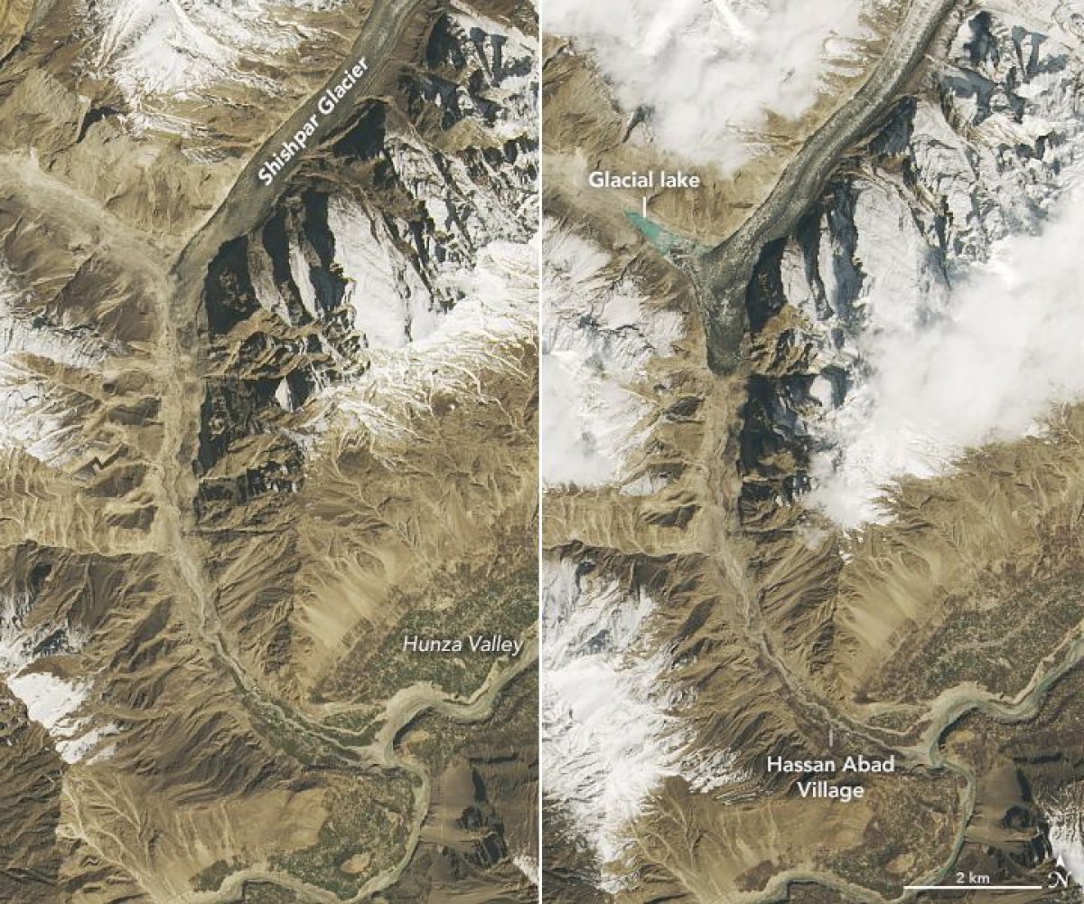
Lakes that form in this way tend to be quite unstable and short-lived, perhaps lasting only for one season. While most drain slowly and do not cause any problems, sometimes the ice dams collapse suddenly, or water spills over the top, causing rapid and potentially dangerous floods.
As such, authorities in Pakistan have kept a close eye on the glacier to monitor the flood risk by analyzing satellite imagery every day.
The glacier surge has already caused problems for those living in the local area by cutting off the water supply to a nearby power station and blocking a key pathway that miners and cattle regularly use.
Uncommon Knowledge
Newsweek is committed to challenging conventional wisdom and finding connections in the search for common ground.
Newsweek is committed to challenging conventional wisdom and finding connections in the search for common ground.
About the writer
Aristos is a Newsweek science reporter with the London, U.K., bureau. He reports on science and health topics, including; animal, ... Read more
To read how Newsweek uses AI as a newsroom tool, Click here.