When Hurricane Florence struck the U.S. last month, rain and wind weren't the only causes of damage. Rising seas contributed to storm surges that reached nearly 20 feet in some estuaries.
In the past 20 years, sea levels have risen about 3 millimeters per year, which has affected coastal flooding. How much more will the seas rise in the coming decades?
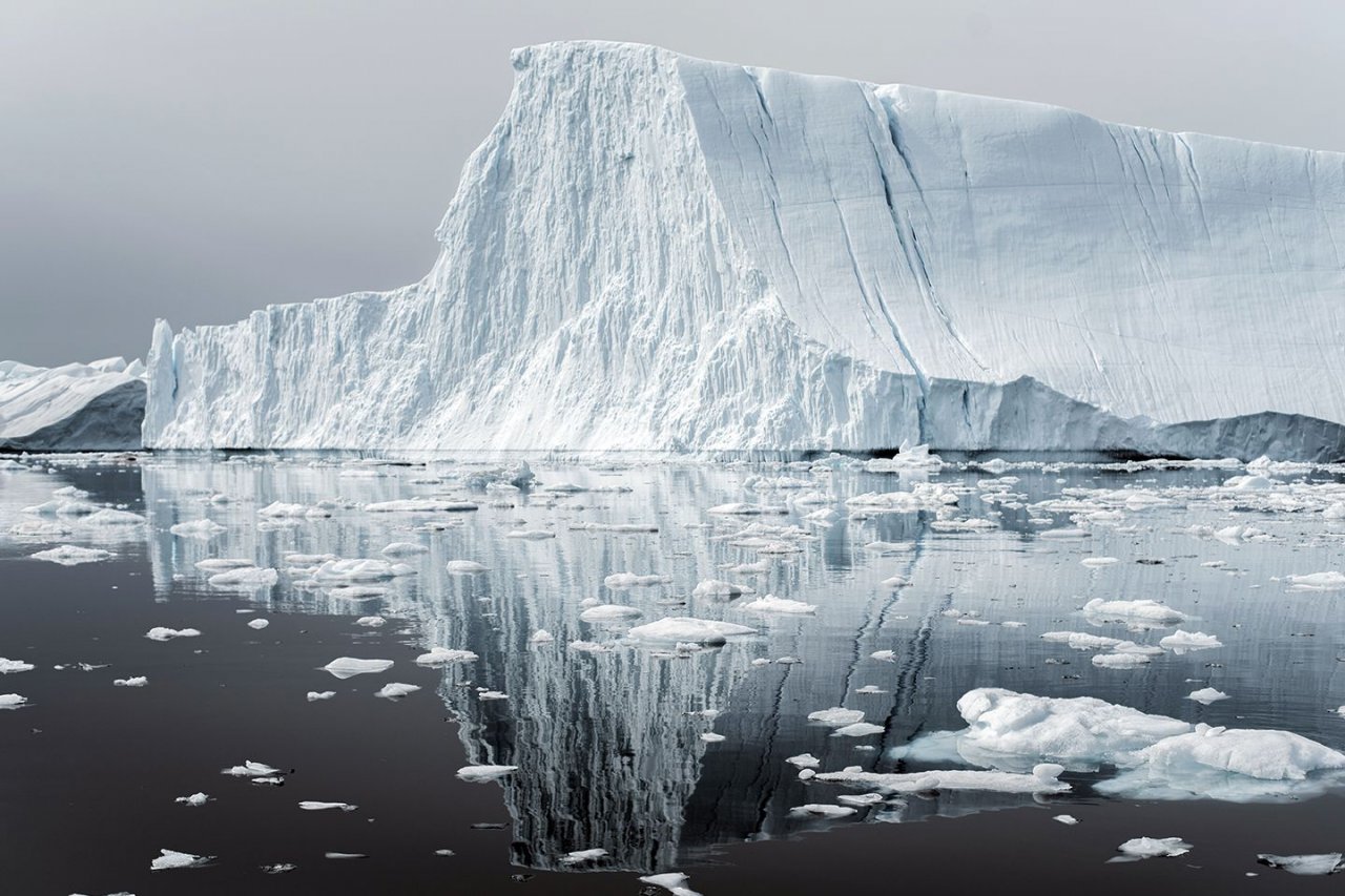
The North and South poles are a good place to look for an answer. Melting ice in Greenland and Antarctica is a big cause of rising seas; Greenland has enough ice to raise sea levels by 21 feet. Loss of ice at the North Pole could shut down the Gulf Stream, plunging Northern Europe and Scandinavia into a deep freeze—a scenario depicted in the 2004 sci-fi movie The Day After Tomorrow.
"It wouldn't happen as dramatically as in the movie," says physicist Thorsten Markus, who studies polar ice at NASA's Goddard Space Flight Center in Greenbelt, Maryland. "But that is basically the idea. If the circulation shuts down, everything changes dramatically."
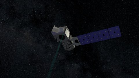
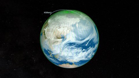
Newsweek spoke to Markus, a project scientist for the NASA satellite ICESat-2. Launched in September, it measures polar ice by bouncing laser beams off the Earth's surface. The elevation readings it obtains are accurate within the width of a pencil.
How does ICESat-2 help in understanding the rise of sea levels?
The main objective is to measure the height of floating ice on the ocean, as well as the height of the ice sheets over Greenland and Antarctica. Better understanding of those processes will ultimately improve our predictions of what will happen in the future. The only way you can make accurate predictions is by continued monitoring and data acquisition.
How does the satellite compare with its predecessor?
The original ICESat fired a single beam of light 40 times a second, allowing it to measure elevation about every 560 feet along Earth's surface. ICESat-2's laser is split into six beams and fires 10,000 pulses a second, scanning the ground every 2.5 feet. That's very, very high-density data. We get much higher resolution—it's unbelievable.
What's the difference between sea ice and ice sheets?
Sea ice forms when ocean water freezes. It drifts around, and it can last for a season or maybe longer. We have a very good handle on the coverage from the satellite images, but what's eluded us is the thickness.
Sheets, like those found in Greenland and Antarctica, are completely different beasts. They are miles thick, and the only source for this is snowfall. It falls, compacts over time and becomes ice. Ice sheets move slowly downstream over the course of decades, and eventually pieces break off to form icebergs. If this is a stable system, then the amount of snowfall will equal the amount of ice that breaks off.
Are the ice sheets stable now?
No. They are losing a lot of mass each year; Greenland alone loses 250 gigatons a year. Roughly one-third of observed sea level rise comes from melting ice sheets, so if they go away, sea level will increase. That spells trouble for coastal areas like Florida.
What happens when sea ice, which floats on the ocean, melts?
There is no effect on sea level because it's already in the ocean—think of a melting ice cube in your drink—but it can change climate and weather patterns far beyond the poles. Sea ice is white, which means it reflects the sun. When it melts, the dark ocean absorbs more energy from the sun, ultimately raising global temperatures, which in turn cause glaciers and ice sheets on land to melt further. As ocean water gets warmer, it expands. What's happening in the polar regions is very important to our climate, our cities and our [gross domestic product] in general.