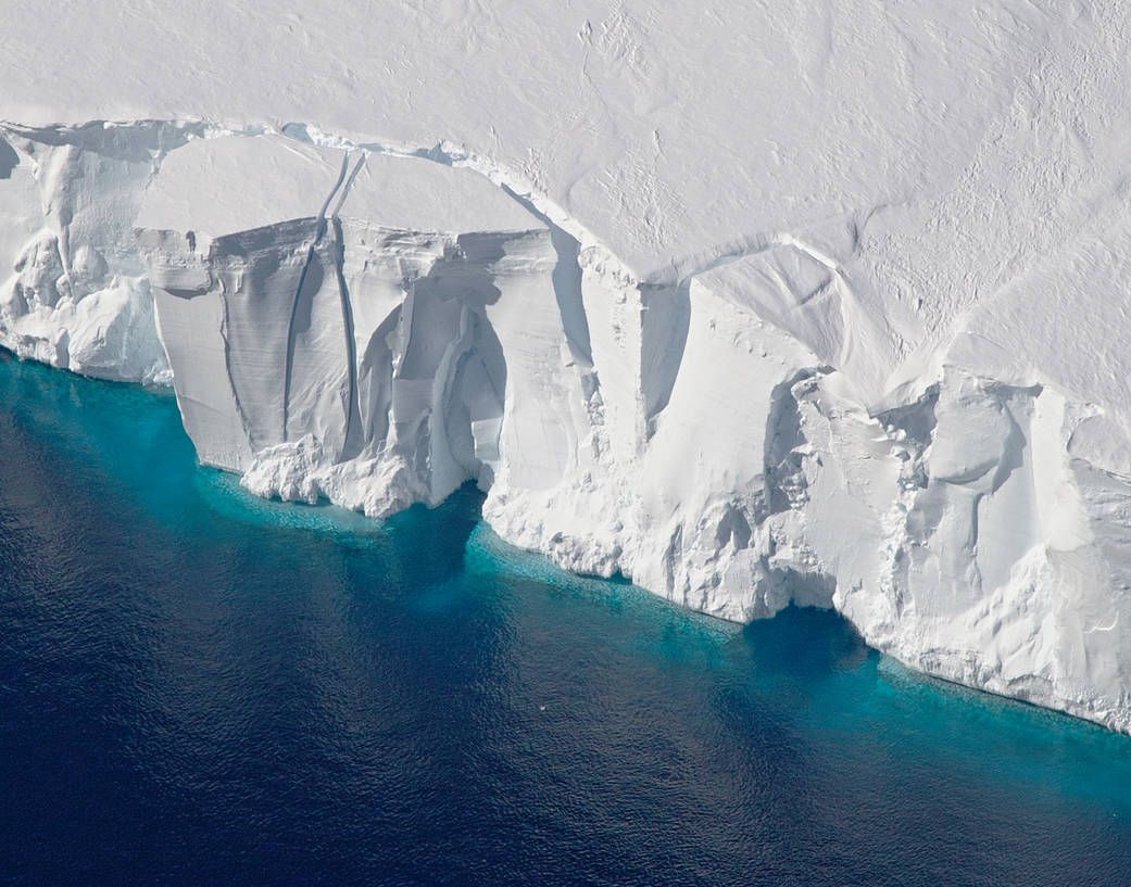
NASA recently published a study uncovering just how fast Antarctica's ice sheets are flowing into the ocean. Scientists used a new technique compiling hundreds of thousands of high-precision satellite imagery to illuminate the speed of glaciers—which act like massive solid rivers—sliding into the sea. Understanding this speed helps scientists pinpoint how much sea levels will rise due to melting glaciers.
"We're entering a new age," Alex Gardner, lead author and cryospheric scientist at NASA's Jet Propulsion Laboratory, said in a statement. "When I began working on this project three years ago, there was a single map of ice sheet flow that was made using data collected over 10 years, and it was revolutionary when it was published back in 2011."
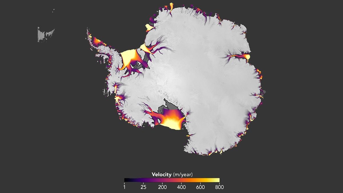
The findings, published February 13 in The Cryosphere, reveal accelerating ice flow in the West Antarctic ice sheet, and a steady flow in the East. Much of the findings confirm what previous studies have shown, but using more direct and precise measurements of the ice sheets.
Based on seven years of images from 2008 to 2015, scientists found glaciers were accelerating into Antarctica's Getz ice shelf in the southwestern part of the continent—the most significant and previously unmeasured finding, according to NASA. Glaciers flowing into Marguerite Bay were also measured speeding up by 1,300 to 2,600 feet per year—the quickest over the seven-year period. Thwaites and Pine Island glaciers in the West were also accelerating, though the acceleration appeared to be slowing down. A silver lining in the findings, however, is that the ice flow of the East Antarctic ice sheet has continued at a steady rate.
The satellite imagery technique shows the entire continent—and even clouds or poor quality conditions don't obstruct the view of ice sheets in these images. The satellite data was gleaned from the NASA—U.S. Geological Survey Landsat images, documenting changes in ice sheet motion. Since Antarctica is so massive, it would be near impossible to measure ice sheet changes in another way. Plus, different regions of the icy continent are flowing at different speeds, which these images can show us.
"We'll be able to use this information to target field campaigns, and understand the processes causing these changes," Gardner said. "Over the next decade, all this is going to lead to rapid improvement in our knowledge of how ice sheets respond to changes in ocean and atmospheric conditions, knowledge that will ultimately help to inform projections of sea level change."
Uncommon Knowledge
Newsweek is committed to challenging conventional wisdom and finding connections in the search for common ground.
Newsweek is committed to challenging conventional wisdom and finding connections in the search for common ground.
About the writer
Sydney Pereira is a science writer, focusing on the environment and climate. You can reach her at s.pereira@newsweekgroup.com.
To read how Newsweek uses AI as a newsroom tool, Click here.