Antarctica has become the best-mapped continent on Earth with a new high-resolution terrain map showing the ice-covered landmass in unprecedented detail. The Reference Elevation Model of Antarctica (REMA) map has a resolution more than 100 times sharper than previous representations.
"At this resolution, you can see almost everything," Ian Howat, who developed the map, said in a statement. "It is the highest-resolution terrain map by far of any continent. Up until now we've had a better map of Mars than we've had of Antarctica. Now it is the best-mapped continent."
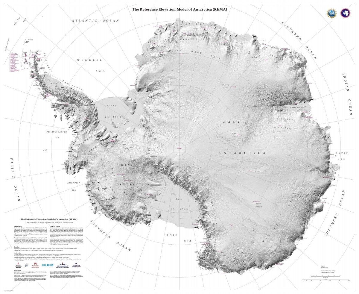
Howat, a professor of earth sciences at Ohio State University, and his team used supercomputers to process vast quantities of data: 150 terabytes in total. To put that into perspective, as of 2014 the U.S. Library of Congress had around 525 terabytes of web archive data.
The team started by using images taken from satellites that orbit the polar regions. Hundreds of thousands of individual models were extracted from pairs of satellite images.
The software, developed by Howat and his colleagues, was then used to create the map. "REMA provides the first high-resolution, high-accuracy terrain dataset of approximately 98 perecnt of the contiguous continental landmass of Antarctica extending to 88°S," the project's website noted.
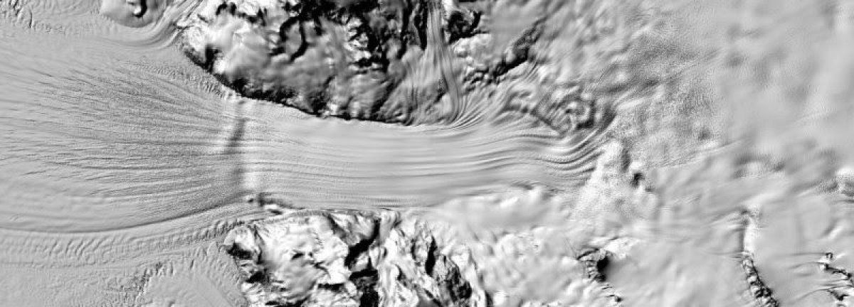
Howat said the map will be instrumental to the scientific community: "We can actually see variations in the snow in some places. We will be able to measure changes in the surface of the continent over time. We will see changes in snow cover, changes in the motion of ice; we will be able to monitor river discharge, flooding and volcanoes. We will be able to see the thinning of glaciers."
The map has been welcomed by experts across the globe. Mark Drinkwater, head of the European Space Agency's Earth and Mission Science Division, called it "spectacular," while Greg Cocks, a data scientist with the USGS, said it provided a "stunning" view of the continent.
Absolutely spectacular new REMA hires. (8m) digital map and reference DEM of Antarctica (happy to see vertical registration using @ESA_EO #CryoSat data to achieve excellent result)! https://t.co/eB7sEX2bYo
— Mark Drinkwater (@kryosat) September 8, 2018
Thanks to satellites, a s***ton of computer power, and a lotta work, we now have a more detailed map of Antarctica than we do of any other continent.
— Mike MacFerrin, Glaciologist (@IceSheetMike) September 7, 2018
You’ll need 150 TB to download the whole thing. #REMA https://t.co/IqOpDBIcA7
A terrain map that shows Antarctica in stunning detail
— Greg Cocks (@gregcocks_kiwi) September 7, 2018
Project allows scientists to see continent in high resolution
Reference Elevation Model of Antarctica (REMA)#REMA #Antarctica @OhioState #elevation #remotesensing https://t.co/E6TqCUjsud pic.twitter.com/pYEyBq7y0Y
To access the full map, click here.
Uncommon Knowledge
Newsweek is committed to challenging conventional wisdom and finding connections in the search for common ground.
Newsweek is committed to challenging conventional wisdom and finding connections in the search for common ground.
About the writer
Hannah Osborne is Nesweek's Science Editor, based in London, UK. Hannah joined Newsweek in 2017 from IBTimes UK. She is ... Read more
To read how Newsweek uses AI as a newsroom tool, Click here.