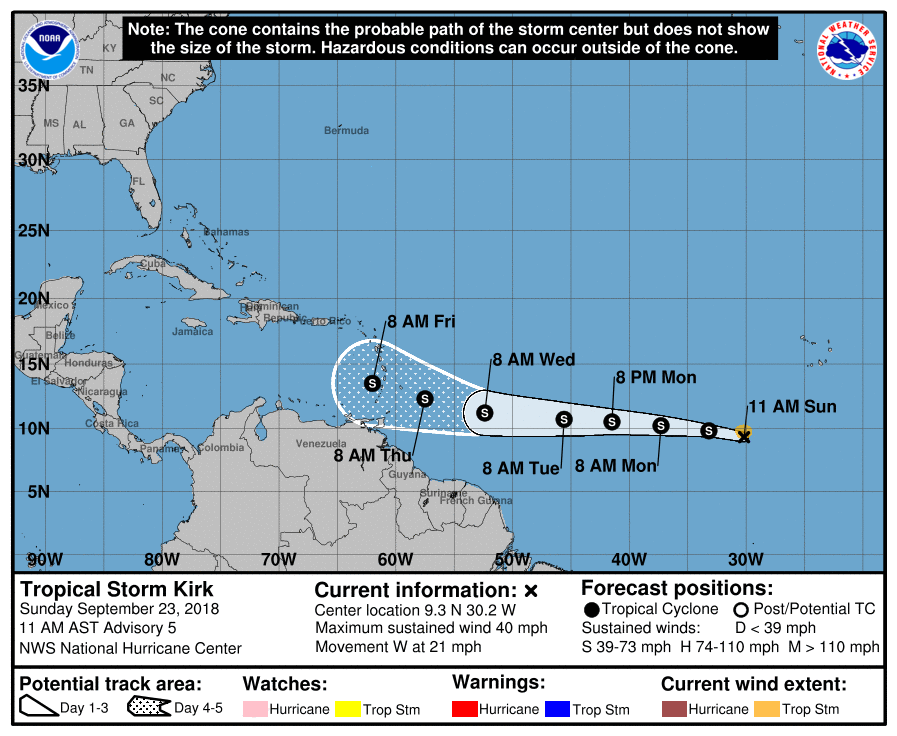
Tropical Storm Kirk, located about 500 miles southwest of the southernmost Cabo Verde Islands on Sunday after developing into a named storm on Saturday, may never reach hurricane strength, according to the latest forecast models update.
The National Hurricane Center said Sunday that Kirk, with winds of 40 miles per hour, might strength in the next couple of days, but is likely to get torn apart by wind shear before it can do much damage.
"The storm will be moving over warmer waters with fairly low shear for the next day or two, so some strengthening is anticipated in the short term," the National Hurricane Center said Sunday. But it may be all bluster for Tropical Storm Kirk, since wind shear could dismantle the storm before the end of next week.
"Later in the forecast period, increasing westerly shear should cause weakening. The official intensity forecast is similar to the model consensus through 48 hours, and follows the trends shown by the ECMWF and GFS global guidance thereafter," the NHC said. "The latter models suggest that Kirk could open up into a trough when it nears the Caribbean."
Forecasters at the Weather Channel agree.
"This strong wind shear is expected to rip Kirk apart, possibly to the point of degenerating it into a tropical wave by the time it reaches the Windward Islands later Thursday or Friday," weather.com reported Sunday.
Meanwhile, the remnant of Hurricane Florence may bring some rain to eastern North Carolina next week, forecasters said Sunday.
Dubbed Invest 98L by the NHC, the Florence remnant is a "broad area of low pressure located between Bermuda and the Bahamas" that "continues to produce limited shower and thunderstorm activity."
"The strong upper-level winds currently affecting the system are expected to diminish, and this could favor some development during the next couple of days," the NHC said.
The National Hurricane Center gives Invest 98L a 30 percent chance of developing into a named tropical depression or storm within the next five days, according to its latest update Sunday morning. The next named storm would be Leslie.
If the storm does indeed track to North Carolina, the "main impact of this system may be an uptick in the chance of showers in eastern North Carolina, possibly the Virginia Tidewater, Tuesday into early Wednesday before the system glides into the north Atlantic Ocean," reported weather.com. "No heavy rainfall is expected from this system."
Uncommon Knowledge
Newsweek is committed to challenging conventional wisdom and finding connections in the search for common ground.
Newsweek is committed to challenging conventional wisdom and finding connections in the search for common ground.
About the writer
To read how Newsweek uses AI as a newsroom tool, Click here.