Dangerous changes to Alaska's frozen rivers during winter—including the appearance of hazardous sections of open water—can now be detected via satellite.
Researchers from the University of Alaska Fairbanks developed a new technology to detect open water zones when the state's rivers freeze over in the early winter. The classification system using synthetic-aperture radar (SAR) could also be used across the Arctic, where open water zones present the same hazard.
The idea is that this can then be used to create hazard maps for those traveling, as many Alaskans do in rural areas. The frozen rivers act as "ice highways" and many people travel across them to fish and hunt.
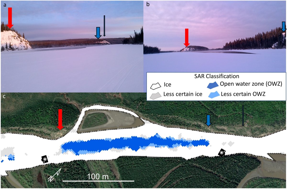
"With this ice classification, we're trying to distinguish between ice and open holes in the ice," remote sensing scientist Melanie Engram of the Water and Environmental Research Center at the UAF Institute of Northern Engineering, who led the research, said in a statement. "A lot of studies have been done, especially in Canada, looking at different types of ice. We didn't do that. We just went ice versus open water."
The new detection method is detailed in a Remote Sensing of Environment study.
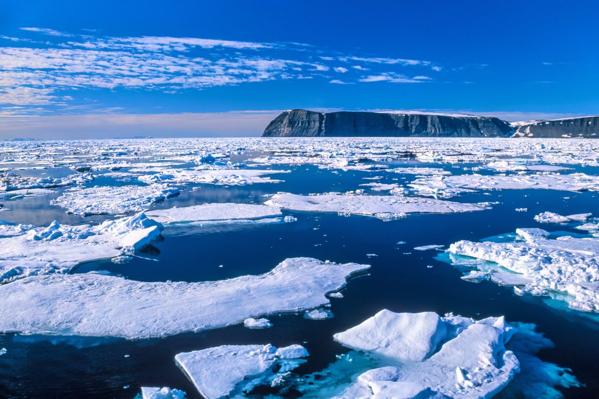
Open water zones can be highly dangerous. And as climate change continues to worsen, rivers are not freezing in the same way they used to. The study noted that arctic warming has caused later freezing, which is impacted rural winter river travel. This is causing open water zones in mid-winter, and an earlier break-up of ice.
Engram worked with colleagues to develop the river ice classification system from data across eight Alaska rivers. Their focus was on developing a method that would work across October until January, when the open water zones present a threat.
"This can be customized and automated for any northern latitude rivers to provide current open water zone maps. It's not designed just for Alaska," Engram said. "We had shore-based cameras all over the state, and they took a picture of the river every day. And we consulted with communities, asking, 'What's important to you?'"
Sections of eight rivers were looked at during the study—Colville, Noatak, Tanana, Yukon, Kantishna, Innoko, Copper and Kuskokwim. The areas studied had different volumes, widths, glacial silt content and channel types.
"We're really fortunate in that scientists have access to that data, not just at the University of Alaska Fairbanks, but worldwide," she said. "The Alaska Satellite Facility has made SAR data much more usable for any type of scientist. You don't have to be a SAR specialist."
Do you have a tip on a science story that Newsweek should be covering? Do you have a question about open water zones? Let us know via science@newsweek.com.
Uncommon Knowledge
Newsweek is committed to challenging conventional wisdom and finding connections in the search for common ground.
Newsweek is committed to challenging conventional wisdom and finding connections in the search for common ground.
About the writer
Robyn White is a Newsweek Nature Reporter based in London, UK. Her focus is reporting on wildlife, science and the ... Read more
To read how Newsweek uses AI as a newsroom tool, Click here.