The huge volumes of rain that were dumped over Los Angeles and surrounding regions over the last week, causing flooding, mudslides and mass destruction, can be seen in a new NASA map.
The map reveals the average rainfall rate per hour across the area between the afternoons of February 4 and February 6, as estimated by satellite data.
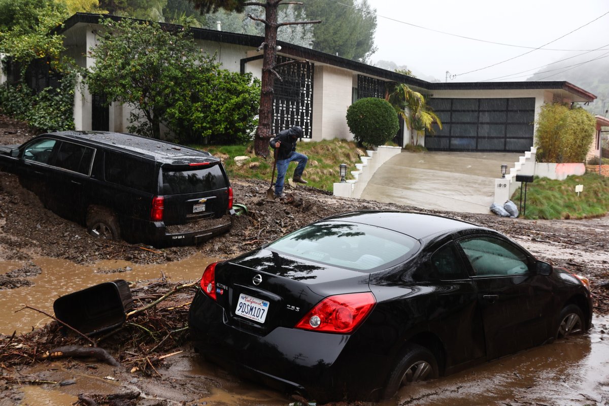
The rainfall was so heavy that a state of emergency was declared for several counties in Southern California on Sunday, with power being knocked out for thousands of residents amid flash floods and mudslides. Several lives were lost.
National Weather Service data shows that parts of Los Angeles County saw over 13 inches of rainfall across the four days prior to February 6. Monday and Tuesday was the wettest two-day period in Los Angeles since 1956, with 7.03 inches falling over the 48 hours.
Los Angeles usually only sees 3.64 inches of rain across the entire month of February. Downtown LA's yearly average rainfall is only about 14.25 inches.

Atmospheric rivers are enormous streams of water vapor that form in the tropics and move over land, bringing with them heavy rain and snowfall. The storm that hit California only one week before this storm was known as a Pineapple Express, as it originated near Hawaii.
"Increasingly saturated conditions and ongoing flooding will be further exacerbated by this additional rainfall, continuing the threat for life-threatening, locally catastrophic flash, urban, and small stream flooding, as well as a threat for debris flows and mudslides," the NWS said in an advisory on Monday, threatening "life-threatening flash flooding"
An NWS Weather Prediction Center map shows the three-day-average total rainfall across Southern California.
Here are the 3-day observed precipitation totals across the state of California from the atmospheric river event this week. Record-breaking amounts of rain fell in southern California, which resulted in significant flash floods, debris flows, and mudslides. pic.twitter.com/9od3kdfFt2
— NWS Weather Prediction Center (@NWSWPC) February 7, 2024
"Record-breaking amounts of rain fell in southern California, which resulted in significant flash floods, debris flows, and mudslides," the NWS Weather Prediction Center said as it posted the map to X, formerly Twitter, on Wednesday.
"It may not rain in California, but it really pours! Significant impacts: flash flooding, rock and mud slides, debris flows, downed trees and powerlines & many swiftwater rescues," NWS Los Angeles said in a repost of the map.
Some 475 mudslides were triggered by the powerful rainfall around Los Angeles, and over 400 trees were blown over by the intense winds. Gusts of 125 miles per hour were recorded at Mammoth Mountain in Central California, with San Francisco seeing gusts of 77 mph. As of Wednesday morning, 70,000 people across California were without power due to damage to the power grid.
A preliminary estimate from Accuweather forecasts $11 billion in damage and economic losses. Nine people have reportedly died across the state from the effects of the storm as of Tuesday, according to the Los Angeles Times, including four from falling trees, and three in car-related deaths. One person was swept from their car into floodwaters, while others crashed as a result of the stormy weather and wet roads.
One small win from this storm, and the other atmospheric river that slammed into California only a week prior, is that the intense rainfall and increased mountain snowpack (which will melt in the spring) may help alleviate some of California's megadrought-parched groundwater supplies. According to Marty Adams, the general manager of the Los Angeles Department of Water and Power, over 1 billion gallons of rain were captured for groundwater and local supplies during this storm alone.
However, a single intense storm isn't quite enough to cure the region of drought, especially considering the encroaching effects of climate change.
"Because of the growing role of warming in causing the drought, it is likely that the region will continue to become more arid until climate change is stopped dead in its tracks," Jonathan Overpeck, dean of environmental studies at the University of Michigan, told Newsweek.
"That said, there will continue to be wetter years where the drought impacts will be lessened, intermixed with a greater number of dry years where the drought impacts will intensify. The only way to get out of an ever-worsening cycle of drought is to halt the cause, and that cause is the burning of fossil fuels and climate change."
Do you have a tip on a science story that Newsweek should be covering? Do you have a question about atmospheric rivers? Let us know via science@newsweek.com.
Uncommon Knowledge
Newsweek is committed to challenging conventional wisdom and finding connections in the search for common ground.
Newsweek is committed to challenging conventional wisdom and finding connections in the search for common ground.
About the writer
Jess Thomson is a Newsweek Science Reporter based in London UK. Her focus is reporting on science, technology and healthcare. ... Read more