For at least six of the past 10 years, Ali Saed, a farmer, grew no crops. The rain in his little corner of northern Iraq was too meager, as was the flow of a nearby irrigation canal. He was only a few months away from ditching agriculture for good when he reached out to a distant relative, a government scientist in Baghdad. Saed was told some farmers had tapped groundwater stores, and he wondered if he might be able to do the same. By sizing up satellite images of the surrounding fields, the cousin identified a nearby dip layered with porous rock through which rainwater might once have seeped.
After pooling cash from his neighbors and calling in a drilling team, Saed hit wet pay dirt early last year. "Thanks be to God, we found water," he says, straddling the new borehole on the periphery of his land. "Finally, we can grow!"
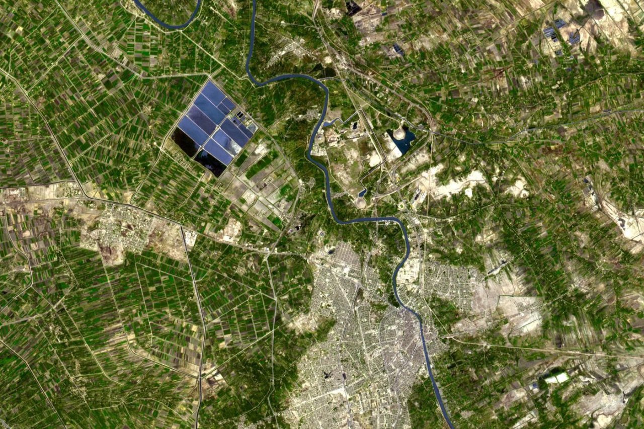
Thanks be to NASA too. Ever since it was established in 1958, America's national space agency has produced a raft of invaluable scientific data. From tracking melting glaciers to identifying mineral deposits, its efforts to accumulate enormous troves of information have helped inform U.S. government decisions and spurred impressive breakthroughs. With up to 30 science-focused satellites in orbit at any one time, it even serves as a sort of one-stop life-saving shop for other countries—like Iraq—that lack eyes in the sky. Since 2008, most NASA research has been freely available from its website.
'It's a Crisis'
Of all the challenges NASA technology has faced on Earth, the one scientists in the Middle East are battling might prove its most daunting. Desperate to head off a regional water crisis, these experts have pinned their hopes on U.S. satellite imagery to boost water efficiency and sniff out additional water resources. At a time when droughts are growing more frequent and populations are booming from Yemen to Morocco, some suggest salvation by satellite might be the region's best chance of averting catastrophe. "Already, we are unable to produce much of the food we need; it's a crisis," says Farouk El-Baz, director of the Center for Remote Sensing at Boston University, an adviser to Egypt's president and a longtime NASA scientist. "But if we can use satellite images to identify suitable water and places with the right soil for agriculture, then we'd be very, very stupid not to use it." Aquifers in the Arabian Peninsula are so tapped out that some countries—notably Saudi Arabia—have had to drop much of their agriculture.
]Nowhere has this technology proved more valuable than in the Middle East. Authorities in Jordan weren't even sure what their farmers were growing until satellite imagery enabled them to build aerial crop maps. They've since cracked down on the cultivation of water-intensive plants, like rice. In Lebanon, where a dysfunctional political system has hampered data collection (there hasn't been a census since the 1930s for fear of upsetting the sectarian balance), satellite imagery has allowed officials to make up the shortfall in information on everything from urban planning to abuse of the food subsidy system. After analyzing the country's farmland from above, the National Council for Scientific Research (CNRS) worked out that farmers were growing roughly half the 20,000 hectares of wheat that they'd claimed. The government was subsequently able to slash its wheat subsidy handouts by over two-thirds.
But it's space technology's capacity to better regulate water usage, and therefore grow more food with fewer resources, that's really excited the science community. By gauging the temperature of a field, which if irrigated properly should be below that of the surrounding area, researchers can determine if a crop is water-stressed or, crucially in the Middle East, consuming more water than it needs. Through measuring the amount of moisture in tree canopies and snow melts, they can learn how much water they'll have to toy with in the first place. "It enables us to make better predictions, to learn how much irrigation will be needed, to see if a country is in a state of drought," says Rachael McDonnell, head of the climate change modeling adaptation section at the Dubai-based International Center for Biosaline Agriculture (ICBA), which frequently partners with NASA.
Unfortunately, the Middle East, already the world's driest region, appears to be getting even drier. And so satellite imagery might really come into its own in the bleakest of circumstances. Using NASA's Landsat program—"the Land Rover Defender of the data world," McDonnell calls it—aid organizations have created drought and famine early-warning systems, through which they try to tackle crises before they worsen. They scan images for signs of desertification and look for indications of widespread vegetation stress. When Morocco was struck by a severe drought last year, which cut grain production by almost 60 percent and led to the loss of almost 200,000 agricultural jobs, remote-sensing analysts took the lead in pinpointing and directing assistance to the worst-affected areas.
Still, satellite imagery's rollout hasn't been without its problems, in large part because many governments have yet to recognize the technology's importance. On many occasions, quality research and useful data never reach policymakers, instead gathering dust on bureaucrats' desks. "One of the big problems in the entire Arab region is that we can do the science, but a lot of it's just thrown in a drawer," says Chadi Abdallah, a researcher at Lebanon's CNRS. In other instances, underappreciated national science institutes have been among the first to lose their funding during economic crises. Egypt's lone science satellite, NileSat, is out of operation for financial reasons; Iraq's science and technology budget has been eviscerated. No manner of high-resolution data from the sky can help when there's no one on the books to interpret the often complicated raw information.
And then there are the security issues. Starting in the 1970s, when El-Baz, then working on the Apollo-Soyuz mission, first brought NASA images to Egypt, many intelligence services have taken a dim view of foreign space technology. Some still see it as overly sensitive, almost a form of spying, and try to regulate its use. In 2015, authorities in Cairo inexplicably denied entry to two American data analysts from the Department of Agriculture who'd come to calibrate their satellite readings on the ground. Other security agencies have brought these institutions under their wing. Most statistics collecting bodies in the Middle East fall under the security services, rendering many of their findings inaccessible to independent researchers. In an unfortunate sign of the times, Lebanese scientists have found that even when they do identify problems via satellite—in this instance, the growth of an invasive plant near Al-Qaa in the country's north—sometimes there's nothing they can do about it. "The war [in neighboring Syria] prevents us from accessing certain areas. We're not allowed to go there," says Ghaleb Faour, director of the Center for Remote Sensing at CNRS.
'Have to Be Smart'
Nevertheless, there are plenty of signs that satellite imagery's role in the Middle East will only get bigger, better—and perhaps slightly less reliant on NASA. Since the 1970s, Americans have dominated the remote sensing field, offering a mostly free—and by far the largest—archive of images. They even broadcast data directly from space to up to 20 countries at a time. "We got a head start on the world," says James Irons, director of the Earth Sciences Division at NASA's Goddard Space Flight Center.
Over the past few years, however, alternatives have emerged, a number of which offer superior resolution—and therefore a wider range of uses—than the Landsat satellites. The European Space Agency launched Sentinel 2A last year, and Sentinel 2B this year, both of which can arrow in more closely than most other publicly available satellites. The ESA recently made some of its data free for the first time, which is crucial given that most Middle Eastern scientists are operating on shoestring budgets. And some private satellite operators that have even superior resolution capabilities have been known to drop their prices when public research institutions ask. "We find a way [to make it work] ," says Kumar Navulur, senior director of global strategic programs at DigitalGlobe, a U.S. company. Lebanon's CNRS pays the company roughly $100,000 every five years to build detailed digital maps of the country. As satellite revisit times and image quality improve, researchers hope that skeptics within their own governments will come to see technology's value.
Above all, though, it increasingly looks as if satellite imagery might be one of the Middle East's few means of confronting its terrifying array of environmental challenges. With most states in the region grappling with some kind of conflict or weak economy, water and food crises are worsening by the day. The solution, it seems, might well have to come from above. "Particularly with climate change, we know we're going to have less water. We're going to have to get much better at managing water across the entire board," says ICBA's McDonnell. "We're going to have to be smart with satellite imagery."
-
Horizons Science
-
-
-
-
-
-
-
-
Features U.S.
-
Downtime Entertainment
-
Periscope SpyTalk